
Recherchez sur le site !
Recherche avancée / SpécifiqueCatégories publications
+ Sciences De La Terre - Archéologie - Astronomie - Spéléologie - Ecologie - Pédologie - Volcanologie - L'hydrogéologie - Géomorphologie - Minéralogie - Pétrologie - Paléontologie - Géologie + Climatologie - Réchouffement climatique - Changement climatique + Plantes - Plantes Aromatiques - Plantes médicinales + Zoologie - Faunes + Botanique - Flors + Sciences humaines - Géo Eco Tourisme - L’anthropologie - L'Histoire - Démographie - Sociologie - Géographie - Patrimoine culturel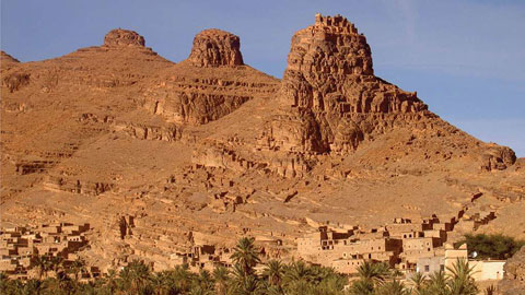
Géo éco tourisme inclusif

Géoparc et Recherche Scientifique
Le coins de l’étudiant


Blog Géoparc Jbel Bani

Evidence for a Panafrican volcanic arc and wrench fault tectonics in the Jbel Saghro, Anti-Atlas, Morocco (Geoparc jbel bani)
By ALI SAQUAQUE, MOHAMMED BENHARREF, HASSAN ABIA, ZAKIA MRINI Marrakech, INGRID REUBER, Grenoble, and JEFFREY A. KARSON, Durham *) With 7 figures
Zusammenfassung
Der Saghro reprfisentiert den nerdlichen Zweig der panafrikanischen Kette im estlichen Teil des marokkanischen Anti-Atlas. Die préikambrischen Serien bestehen weitgehend aus vulkanischem und vulkano-detritischem Material, die Zeugnis einer vorwiegend explosiven Vulkantfitigkeit sind. Diese Serien sind intrudiert yon Dioriten und Graniten. Die Altersbestimmung dieser Serien ist problematisch, und ihre Einstufung ist in vorliegender Arbeit revidiert auf Grund struktureller Beobachtungenund Rb-Sr Alter der intrusiven Quarzdiorite von 754 bis 722 Ma. Damit geheren die penetrative deformierten Serien dem unteren PII an und demoberen PII werden die etwas deformierten Teile des ehemaligen unteren PIII zugeordnet. Nur diejenigen Formationen, die ein charkteristisches Basiskonglomerat oder eine Winkeldiskordanz tiberlagern, werden als PIII eingestuft.
Die Hauptschieferung streicht NE-SW, und wird von einem System konjugierter Scherzonen
durchschnitten. Im Saghro kennen alle Strukturen dieser panafrikanischen Hauptphase durch eine NW-SE gerichtete Einengung erklfirt werden. Die Injektion yon Gfingen und die Kinematik entlang Sterungen im spfiteren Stadium der panafrikanischen
Deformation dagegen deutet auf eine NESW-Einengung.
Der explosive Vulkanismus und die kalk-alkalinen Plutone des Saghro k/3nnen durch einen Inselbogenmagmatismusim Zusammenhang mit dernordvergenten Subduktion entlang des >, accident majeur<< von Bou Azzer - E1 Graara erkl~irt werden (SAQUAQUE et al., 1989). Seine Aktivit~t war gleichzeitig mit den die Subduktion und die Kollision begleitenden Deformationen.
Abstract
The Saghro hills constitute the northern branch of the Panafrican mobile belt in the eastern part of the Moroccan Anti-Atlas. The Precambrian terranes are predominantly composed of volcanoclastic and volcanic series witnessing a mainly explosive volcanism, intruded by diorites and granites.
Their age attribution is problematic, and has been reconsidered in the present study based on structural evidence and Rb/Sr data of quartzdiorites: penetratively deformed volcano-sedimentaries intruded by these plutons aged between 754 and 722 Ma are now considered as Lower Precambrian II. The Upper PII series have been reattributed, and only formations overlying a basal conglomerate and angular disconformity are considered PIII.
Main schistosities are predominantly NE-SW, cut by conjugate sets of strike-slip shear zones. In the Saghro area NW-SE compression can explain the observed structures during this main Panafrican deformation phase, while fault kinematics and dike emplacement related to late deformation events indicate rather a NE-SW compression.
The explosive volcanism of the Saghro area can be related to a volcanic arc, active during the subduction- and collision-related Panafrican deformations.
This arc would be located on the upper plate in respect to the northward dipping subduction zone evidenced in Bou Azzer - E1 Graara inlier (SAQUAQUE et al., 1989a).
Résume
Les boutonnières du Saghro constituent la branche nord de la zone panafricaine mobile dans la partie est de Anti-Atlas marocain. Les terrains précambriens sont essentiellement composts de stries volcano-clastiques et volcaniques témoignant d'un volcanisme prédominance explosive, qui sont intrudres par des diorites et des granites.
Leur attribution stratigraphique est problématique et fut reconsidérée comme Précambrien II inferieur sur la base des données structurales et des datations Rb/Sr des diorites quartziques intrusives entre 754 et 722 Ma. En conséquence la strie PII supérieur a 6t6 red6finie, et uniquement des formations surmontant un conglomérat basal caractéristique ou une discordance angulaire sont considères du PIII.
La schistosité principale est NE-SW, recoupe par des systèmes de zones de cisaillement décrochâtes conjugués. Dans la région du Saghro, une compression NW-SE peut expliquer ces structures associées h la phase de déformation panafricaine majeure, tandis que la cinématique des failles et l'emplacement de dykes liés aux déformations panafricaines tardives indiquent une compression NE-SW.
Le volcanisme explosif du Saghro peut 4tre lid un arc, qui a été actif pendant les événements tectoniques liés 5 la subduction et la collision panafricaines.
Cet arc sera localisé sur la plaque supérieure par rapport une zone de subduction vers le nord retracde le long de l'accident majeur dans la boutonnière de Bou Azzer - E1 Graara (SAQUAQuz et al., 1989).
KpaTgoe coepmaHne
XoaMb~ Carpo oepa3yIOT ceBepny~o BeTBb HanaqbpIIKaHCKOrO MO~I/IYn~HOFO no,ca B BOCTOqHOI~I uaCTtI AaTIa-ATJIaca MapOKKO. )~OKeMrpHficKUe KOnJIeKCbI COCTO~T 3JIecb FJL 06p. II3 ByJIKa-Horei-n40-0caRoqHbiX i~ ByJ~KaHOFeI-n4bIX nopoR, UTO yKa3~,maeT Ha npeo6aa~anne B3pBIBHOPO gy;~-KaHH3Ma B ~TOT nepHoJx. B ~TILY cepn~x HaxoJIgT IIHTpy3HII ~HOpHTOB H FpaHI4TOB. Bo3pacTIlble COOTHomeni4g ~TI/IX cepn~ OCTaIOTC~I neIlCHblMH I/I nOaTOMy 3~ecb HpOBOJInTC~t JIIlCKyCCII~I 06 HTI4X COOTHOEUeI4~X Ha OCHOBaHtII~ cTpyKTypHbD; JIaHHLIX I/I pe3yabTaTOB ~aTtlpOBKI4 no KBapIIeBhlM ~tIopI~ TaM C nOMnIII•IO Rb/Sr H3oxpoHHOFO MeTo~a.
ByaKaHOreHHO-OCa~IouHhIe nopo~bI, ~eqbopMupOBaHHBIe BHe]IpeHHeM nayTOHOB c Bo3paCTOM 722- 754 MmIa. neT, aBTOpbI OTHOCgT K HI4XtHeMy JIOKeM6pFItO KOMnJIeKCa P II, B TO BpeM.q KaK rI~Knnfl oTpe3oK PIII, IIpOIlBJI~IIOIKI/lh He6oabmy~o ~eqbopMam4~o, OHH npwqncazIOW Tenepb K Bepx-
HeMy OTJ~erly P II. B KaqeCTBe ROKeMrptlIYICKOFO KOMnaeKca PIII OHn B~,I;IeJInIOT TO:I~,KO o6paao- BaHI4,q, nepeKpbiBatonlne ~a3aJIbHble KOHFJIOMepaThI, I, IJItI CJIOII, 3aaevalOlaHe c yFJIOBBIM HecoraacHeN Ha nO~CTHJIaIOKtI~X TOJIKIax.
IIpOCTHpaHHe OCHOBHOIYI cJIaHIIeBaTOCTH I/IMeeT ca. 06p. CB-I03 HanpasJieHHe H nepeceKaeTc~ p~tJIOM 3OH pa3JIOMOB xapaKTepa CJIBnFOB. Ha6~ro- /IaeMble B paI~one Carpo cTpygTypltbIe eRiIHtlKbI MOFyT 6blTb 06%~CHettbI CTKaTtleM B C3-t0B HanpaBaeHHH BO BpeM,q r~aBHOfI dpa3bI naHaqbpHKaHCK!
4x JledpopMalIHfI, a pa3aOMbI, xapaKTep BUeJIpentI~ RaeK, CoIIyTCTByton~IIX HO3~IHHM ~eqbopMalIH~M, yKa3bIBatOT cKopee Bcero Ha cXCaTIde B HanpaBaenuH c CB Ha IO3. B3pblBnOfI ByJIKam43M paI~ona Carpo yEa-3bmaeT Ha cyIReCTBOBaItHe ocTpOBHOfI RyrI4, CHItXpOHHOfI C naH-aqbpHKaHCKOfI AeqbopMaiitiefi, CBIt3aHHOfI C cy6~IyKI~HefI H KOaJItIaHefI. ~)Ta Ryra, gO-BVanMOMy, 6biaa pacnoao>KeHa B npe~eaax nJIHTBI, nepeKpgma~o~efi cnajIa~omy~o Ha ceBep 3OHy 3acaCblBaHI4,q, peJItlKTbI KOTOpOfI HaxoJ~ItT B pafloHe By-A33ep - 9a~ Fpaapa.
Introduction
The Moroccan Anti-Atlas domain is oriented NE-SW and shows over a length of near to 700 km a number of Precambrian inliers below only gently folded Paleozoic terranes. In the North it is limited by the South Atlas fault (fig. 1), whereas in the South it is progressively drowned by Mesozoic sediments of the Hammada du Drâ<. The western Anti-Atlas shows outcrops of the oldest terranes Precambrian I corresponding to the Eburnean basement of the West-African craton (CHOUBERT, 1963, fig. 1). Attributed to the Central Anti-Atlas are the Siroua and Bou Azzer inliers that contain the easternmost inlier of Eburnean basement and ophiolitic and arc-related material along the >~accident majeure< Saghro and Ougnat Constitute the Eastern Anti-Atlas and are composed of lower grade rocks, intensively intruded by intermediate to acid plutons and a few basic ones. They are the subject of this study.
In the East, the West-African craton is bordered by a major Panafrican orogenic belt, the Transaharian chain. Its northwestern branch constitutes the >>mobile zone<< of the Moroccan Anti-Atlas (fig. 1A) along the >>accident major<~ of the Anti-Atlas (fig. 1B, CtlOUBERT, 1947), which is underlined by outcrops of ophiolite, and marks the suture zone between the West-African craton in the South and the Panafrican orogenic belt in the North. The inliers along this suture zone as Bou Azzer - E1 Graara and Siroua have consequently attracted detailed studies (LEBLANC, 1975, 1981; LEBLANC & LANCELOT, 1980; SAQUAQUE et al., 1989a, b, Huch, 1988 and SCnERMEmr-IORN et al. 1986; BASSIAS et al, 1988; CrIABANE, 1991; EL BOUKrIARI, 1991, respectively). The terranes in the south, overlying the stable craton are the base of the Stratigraphic scale established for the Precambrian formations of this area (CHOUBERT, 1963; CHOUBERT et al., 1973, 1974; CHARLOT, 1976, 1978, 1982; CLAUER et al., 1982) and are locally studied in detail (I-[ASSENFORDER, 1987; JEANNETrE TISSERANT, 1977).
On the contrary, the Saghro inliers have been only poorly studied, in spite of representing one of the largest outcrops of Precambrian rocks in the Moroccan Anti-Atlas. So far no comprehensive tectonic or geodynamic model has been proposed for this Panafrican mobile zone. Based on new Stratigraphic data and structural analysis the position of the Saghro in respect to the Bou Azzer suture zone will be discussed here.
Stratigraphic
Subdivisions of the Precambrian formations in the Moroccan Anti-Atlas (CHOUBERT et al., 1973) are mainly based on observations from the Western Anti-Atlas (CHARLOT, 1976, 1978/82), located south of the >>accident majeur<<, and consequently overlying the West-African craton, or on observations in Siroua and Bou Azzer - E1 Graara inliers (LEBLANC &; LANCELOT, 1980; DUCROT • LANCELOT, 1976).
This Stratigraphic is based on orogenic cycles: polymetamorphic gneisses are generally considered as PI, and ages are around 1800 Ma or older (CrIARLOT, 1978). Various terranes unconformably overlying these rocks and affected by the major phase of the Panafrican deformation (B1, LEBLANC, 1975, dated 660 Ma. CLAUER et al., 1982) are considered Lower PII, those affected by the late stage deformations only represent Upper PII and series younger than 615 Ma, gently folded and faulted only are called PIII. These are in turn overlain by the Infra-Cambrian Adoudounian carbonates.
Confusion remains from the fact that in his initial definition, Choubert (1963) and Choubert et al. (1973, 1974) suggested different and a larger number orogenic cycles, and his PII had an age from 1800 to approx. 1400 Ma, Upper PII or also called PII-III ranged from 1400 to around 1000 Ma, and all the rest was PIII. This classification, however, could not be substantiated from the more recent radiometric dating (LEBLANC 8: LANCELOT, 1980).
The old Stratigraphic scale has been extrapolated to the much less studied Eastern part of the Anti-Atlas by facies analogies (CHOUBERT op. cit., HINDERMEYER, 1953a, b, HINDERMEYER et al., 1974- 1977, fig. 2). However, not only the validity of facies analogies is doubtful in these predominantly volcanic and volcano-sedimentary series, where lateral fades variations are obviously very important, and characteristic fades are commonly
Diachronous, but also no reconsideration of the Stratigraphic attribution has been undertaken to align with the Bou Azzer area.

Fig.: 1. General situation (A) and location of the Saghro inliers (B) in the context of the Anti-Atlas suture zone. Crosses = W-African craton, dots = Precambrian II of the >mobile zone<; SAF = South Atlas fault, SF = Sidi Flah, KM = KalaaMgouna, other areas are located on fig. 3.We propose now a new attribution of PII (fig.2), based on radiometric ages and structural observations (MR~ et al., 1989, IamD et al, 1989; IGmo, 1989; Ezzoua~, 1989; SAQUAQUE et al.,1989c) to correlate with the stratigraphy of BouAzzer - E1 Graara (LEBLANC, 1981; LEBLANC et al., op. cit.): - granodiorites and quartz diorites from Imiter inlier intruding low grade schists considered of upper PII age have been dated by Rb/Sr isochrones as 754 _+ 16 and 722 + 14 Ma (M~dyi et al., 1989, fig. 2C). These ages fall into the interval of Lower PII, thus the intruded schists are even older.
- These schists are affected by a flow schistosity of variable intensity, equivalent to the deformation observed in very similar series in the northern terrane of Bou Azzer inlier (TErdOUT, 1991; T~rdOUT et al., 1991).

Fig. 2. Synthetic stratigraphy of the Saghro according to HIYDEFJ~EVER et al. (1977) (A) and new observations (B). Rb/Sr isochrones for plutons from Imiter inlier (C), located on fig. 7. Within the terranes previously attributed to the PIII system, a basal conglomerate commonly underlines an angular disconformity observed between the two petrographically distinct series (fig. 5A, B), already distinguished by (HINDERUEYER et al, 1977). The lower one of these units is affected by a fracture schistosity equivalent to the late deformation (B2) in the Bou Azzer inlier. For these reasons, we propose to consider the lower unit as Upper PII, and only the upper one as PIII.
The three major units (Lower und Upper PII, PIII) retained are separated by disconformities of decreasing importance (fig. 2). Rose granites generally attributed to PIII (but not yet dated successfully due to intense alteration) and hyalite dikes intrude abundantly into Lower PII and the newly defined Upper PII but have not been oberserved in the PIII above the disconformity. These acid hypo-volcanic intrusions characterize the transition between Upper PII and PIII (fig. 3).
The lower Precambrian II, a thick volcano sedimentary formation, folded and schistose under tufts. Sills flows and pillow lavas are intercalated.
9T heir chemistry is tholeitic, of MORB affinity according to trace elements (Ni, Cr, Ti) but enriched in LREE (BAJJA, 1987).
The plutons of gabbroic to granodioritic composition dated Lower PII show a calco-alkaline differentiation trend, with various affinities from tronjemitic to nearly potassic (EzzoUAHAIRI, 1989; IGtlID, 1989; ERRAMI, 1990). These intrusions are accompanied by a synkinetic contact metamorphism, during which biotite, cordierite and andalusite crystallized. Triple points of the host rock's schistosity equally prove their syn-tectonic intrusion (IGmD et al., 1989, fig. 7).
The Upper Precambrian II in the Saghro, the newly defined unit, is composed of volcanic flows and falls, and volcano-sedimentary deposits that alternate laterally and vertically. Eruptive dynamics can occasionally be reconstructed.
- Vertical succession of a fall dominated unit overlain by pyroclastic and lava flows is shown in the area of Ait Hammouden - Air Youl (Kalaa Mgouna inlier, fig. 4A): coarse grained tufts, alternating coarse and fine grained tufts, tufts and tuffites with sedimentary structures such as convolute bedding, synsedimentary faults and graded bedding are overlain by andesitic flow, andesitic tufts, ignimbrites, lapillus and blocks.
- Few kilometers SW, around Tawrir N'Tamgalount similar two units are distinguished laterally (fig. 4B):
- In the west, a massive unit composed predominantly of pyroclastic flow with sub-ordinate lava of deictic to andesitic composition, overlies a basal conglomerate or directly the PII formations. This basal conglomerate is composed of angular pebbles originating from the volcano-sedimentary and plutonic of Lower PII. Grain size distribution and sedimentary structures indicate them to be local channel deposits. The lower deictic flows, pyrite-rich and of characteristic red colour, are equally lenticular, filling small depressions in the topography of the Lower PII erosional surface.
Later dacites rich in quartz phenocrysts in a feldspathic groundmass cover larger areas, as the Palaeo-relief is smoothened.
In the NE a stratified unit composed of alternating cinerites and coarse tufts, overlies directly the Lower PII series. Pyroclastic breccia is locally developed in the high parts of the sector.
This facies distribution allows locating the eruptive center(s) that emitted the mapped volcanic, in the area of the pyroclastic breccias. The stratified pyroclastic would represent sub-Arial falls possibly deviated north-eastwards by predominating winds. The flows, on the contrary, followed the topography into the lower parts located towards the west (fig. 4C). In other areas like Bou Izergane, in the SE of Awrir N'Tamgalount, hypo volcanic bodies in the center of cogenetic pyroclastics and again in topographic highs would equally represent centers of volcanic activity.
- In the Mellab area of Ougnat inlier, the section of Upper PII series is complete (fig. 5A, B):
- A basal conglomerate of similar composition represents certainly again channel fillings.
- The basal ignimbrite is lenticular and spatially related with the conglomerate outcrops. It is poor in fiammes, but rich in phenocrysts of feldspathic and globular quartz, underlining its rhyolitiques composition.
- The lower ignimbrites are wider spread and highly porphyry, quartz rich at their base, quartz poor at the top indicating a change from rhyolitiques to deictic composition, marking the transition to the andesitic flows.
- The final ignimbrite is sub-aphyric, highly silicified and rich in large (20 x 1 mm) fiammes, giving the rock a planar structure. These are elongated in northeasterly directions throughout the area.
- Dikes cutting only the basal part of the series are interpreted as feeder dikes, their orientation is around NNW-SSE, whereas those cutting whole the sequence are oriented N 0 to 30 E (fig. 5C).
The north to south increasing thickness of the ignimbrites and the local occurrence of the basal units again witnesses the topography of Lower PII palaeo-surface (fig. 5D)... The parallelism of fiammes elongations and their orientation nearly perpendicular to the feeder dikes points to a fissural feeder system. 'En echelon' disposition of dike overlaps (fig. 5A) can be related with sinisterly strike slip movements along the Owed N'Oukrouz major fault zone (DAGALLIER et al. 1987).
The Precambrian III has been reconsidered: Only the acid to intermediate volcano-detritic series together with a well developed basal conglomerate composed of well rounded pebbles of andesitic to dacitic composition corresponding to the Upper PII series, are now considered to represent PIII. This unit is present in the southern part of Saghro inlier (fig. 3) and in the Ougnat massif (fig. 5A).
A comparison with the Bou Azzer and Siroua inliers shows that:
- The lower PII is substantially different, as no ophiolitic remnants are observed in the Saghro area. The volcanoclastic series resemble by composition, metamorphic grade and deformation style to the northernmost Lower PII terrane of the Bou Azzer inlier (SAQUAQUE et al., 1989a). Plutons intruding these series are of the same nature, but systematically slightly younger than their equivalents in the Saghro (CHARLOT, 1976, 1978/82; DUCROT, 1979).
-- The Upper PII of Bou Azzer inlier is composed of the specific Tiddiline series, representing filling of local intra-montanous basins (HEFERAN et al., in press), and thus cannot be compared to any formation in the Saghro. In the Siroua it is equally a detritic and volcanic formation, the Lmakhzane formation (REvisor, 1988), initially correlated with the series in the Saghro now attributed to the Lower PII:
- The PIII series as described from these two areas (DIALLO, 1989; AZIZI SAMIR, 1990) are comparable to both, Upper PII and PIII in the Saghro.
No difference in deformation neither a conglomerate horizon can be taken as criteria to deride the formation. Local disconformities are related to active syn-sedimentary tectonics (AzIzI SAMIR et al., 1990). As lower PII formations are possibly younger in the suture near inliers than in the Saghro, the same may be true for the typical volcani-clastic formations that here would be truely of PIII age.
The facies typical for this PIII (or Ouarzazate formation) would in reality be diachronous and its volcanic activity related deposition appears to migrate from north to south.


Fig. 3. Geological map of the Saghro area after HINDEe, MEYER et al. (1977), modified and location of detailed maps. PII> = Upper PII:vs = volcano-sedimentary series, y = granites, Q = rhyolite dikes; PII< = Lower PII:vs = volcano-sedimentary schists, 0-o = gabbroic to granodioritic plutons; blank = Paleozoic and recent cover.


Fig. 4. Detailed maps of key areas in Kalaa-Mgouna inlier (A,B) showing the distribution of newly defined Upper PII series and interpretative block diagram showing the depositional environment during the Upper PII as deduced from figure 4B (C). Symbols are the same as in figure 3, except for the Upper PII = PII>: c = basal conglomerate, dac = dacitic flow, m = andesitic tuff, cd = andesitic lava, ai = andesitic ignimbrite, br = pyroclastic breccia, lap = lapilli flow, ct = cineritic tuff, tc = coarse grained tuff, ff = fine grained laminated tuff, 9 = rhyolite.
Structural data
A main deformation event resulting in a penetrative schistosity affecting the Lower PII formations is overprinted by open folding locally developed fracture schistosity, affecting the Upper PII series as well. By analogy with the Bou Azzer inlier, the first one could be called B1 and the second one B2 (LEBLANC 1975, 1981).
The main schistosity in the Lower PII volcano Sedimentary generally is due to plastic flow under greenschist facies condition, increasing up to amphiboles conditions in the vicinity of the intrusive plutons. It represents the axial plane of local open to isoclinals folds. Its orientation changes from N 30 E in Ougnat and N 50-80 E in Imiter and Boumalne to N 100-130 E at Kelaa Mgouna and Sidi Flah (fig. 6). More complicated patterns in the western part can be related with a stronger effect of the overprint, resulting in multiple kink bands and / or the higher abundance of plutons as around Bouskour. Moderate dip values are dominant towards the south and SE, only locally (Imiter and Boumalne) towards the NW. Lineations associated with this main schistosity are generally dip parallel in the eastern part, but become progressively oblique towards the west, indicating an increasing component of strike slip movement (fig. 6). The asymmetry of folds, S-C structures and rotated minerals indicate south-eastward thrusting in Imiter and Boumalne (fig. 7), more or less oblique north-westward thrusting in the western part.
Strike slip shear zones developed during the late stage of the main deformation. The main couloirs are east-west as in Imiter and Boumalne, and a dextral displacement is indicated by the reorientation of the prior schistosity and internal structures as mentioned above (fig. 7). Conjugate sinistral shear is observed in NW-SE striking shear zones developed in the western and eastern end of the area (Bouskour - Sidi Flah and Ougnat, fig. 6).
The plutons show internal structures related to magmatic flow, partly overprinted by post consolidation plastic flow foliation. The latter foliation in general is concordant with the schistosity of the host rock. Sets of conjugate smal scale shear zones are common in the corresponding directions (E-W dextral and NW-SE to NNW-SSE sinistral). Steeply dipping, weak magmatic flow planes are common in the NW-SE elongated plutons in Bouskour and Imiter inliers parallel to their elongation (fig. 7). They are associated with a vertical flow line. This configuration pleads for vertical magma ascent into >>Mega tension gashes<< coeval and related with the main Panafrican deformation in the Saghro area.
Late structures are dominated by sinistral faults in north-eastern directions. A parallel fracture Schistosity is developed in their vicinity and open kink folds follow the same kinematics (fig. 6. N-S to NNE-SSW striking dikes injected at the transition of Upper PII and PIII represent tension gashes in a NE-SW to ENE-WSW striking sinistral Riedel system (fig. 3). Interpretation of these structural elements indicates a NW-SE compression during the main deformation phase of the lower PII formations in the Saghro. Vergence, however, is alternating NW or SE. Intrusion of dioritic to granodioritic plutons and sets of strike slip shear zones fit into the same pattern: E-W striking dextral fault zones and a NNW-SSE striking sinistral shear zone family form a system of conjugate strike slip zones, pointing to a NW-SE compression. In the late stage the compression rotates towards NE-SW, to generate a N-S to NE-SW orientation of the rhyolite dikes and sinistral shear along ENE-WSW fault zones.
Comparison of this pattern with those proposed for the suture areas, shows direct analogies with the main east-western dextral shear zone of the Siroua (WALLBRECHER, 1988). However, a certain contradiction exists during the main Panafrican deformation with the Bou Azzer - E1 Graara area, Where the northward dipping WNW-ESE striking subduction zone is associated with a southwestward oblique sinistral thrusting, that only very locally (Ousdrate) reversed its vergence (SAQUAQUE et al., 1989b). This kinematics indicates NESW compression, which is directly equivalent to the later stage observed in the Saghro. One explanation may be diachronism of the main Panafrican deformation, as evidenced by the ages of syntectonic intrusions that are between 760 and 720 Ma for the Saghro, around 680 Ma for the early plutons in Bou Azzer - E1 Graara and as low as 615 Ma for the late ones here (M~M et al., 1989).

Fig. 5. Detailed map (A), Stratigraphic column (B), directional rose diagram for dikes (C) and interpretative block diagram (D) for the Upper PII volcanic series in the Mellab inlier of Ougnat massif. Figure pattern are the same on A, B, and D.

Fig. 6. Tectonic sketch map of the Saghro, symbolizing main structures (squares) of each sector, and equal area plots (lower hemisphere) of schistosities ($1) and Lineations (L1), figures in brackets = number of measurements, isoclines >O, >2, >4%.

Fig. 7. Kinematics of Imiter inlier, located on figure 3, after Ighid (1989), black ellipses visualize total strain estimated by Rf/phi methods applied on metamorphic patches near to plutons, or quartz gains elsewhere.
Paleogeodynamic setting with the recognition of a fore-arc and arc complex in Bou Azzer - E1 Graara, related with the northward dipping subduction zone (SAQUAQUE et al., 1989a), the Saghro terranes can be inserted within this context. In fact, lower PII formations are likely to have been deposited in an arc environment, where sedimentary basins and magmatic centers alternate. The calc-alkaline differentiation trends of the plutons and their low initial ratio for Sr87/Sr 86 (fig. 2C) indicate their origin from a mantle slab overlying a subduction zone. Furthermore, ultramafic xenoliths, and small ultramafic bodies (werhlite and clinopyroxénite) in the Bouskour area might represent relicts of an oceanic basement (EZZOUAHAIRI, 1989). Local intra-arc or fore-arc spreading, during the more than 100 Ma of subduction and arc activity evidenced, may well lead to rotation of larger areas or to changes in the stress pattern to explain the observed kinematic differences of the main deformation.
Increasingly silica rich magmatism during Upper PII and PIII can be related with the increasing maturity of the arc, as its crust thickened, and finally explained in a post-collisional context of E-W extension (AzIzI SAMIR, et al. 1990) overlying a relict subducted slab.
Conclusions
The Stratigraphic attribution of volcano sedimentary formations in the Saghro inlier, intruded by syn-kinematic plutons dated 754 to 722 Ma, is now considered to be Lower Precambrian II. Volcani-clastic series overlying discordantly the preceeding ones are consequently considered Upper PII, granites and rhyolites terminate this cycle and are discordantly overlain by PIII conglomerates and volcano-detritics.
The main deformation phase in the Saghro is characterized by ubiquitous flow schistosities and local conjugate shear zones formed in response to a NW-SE compression. During the late stage, compression turns to NE-SW directions that are compatible with those found in the Bou Azzer - E1 Graara inlier.
The whole area can be interpreted as a complex arc domain, related with the northward dipping subduction zone evidenced along the >>accident majeur<< (Bou Azzer - E1 Graara to Siroua).
Acknowledgements we thank H. Ezzouahairi, A. Fekkak and L. Ighid for contribution of structural data from Bouskour, Sidi Flah and hniter respectively. I.R. is particularly grateful to M.R. Azizi Samir for discussion and help in the final stage of revising the manuscript and to V. Jacobshagen for his continous interest in our paper. Thanks are equally due to RK. Kepezhinskas for the Russian summary.
References
AzIzI SAMIR, M. R. (1990): Gdologie du Prtcambrien terminal (III) et traitement statistique des donntes g4ochimiques de prospection dans la boutonnitre de Bou Azzer - el Graara, Anti-Atlas, Maroc. - Thdse doctorat, Univ. Grenoble, 292 p.
--, FERRANDINI, J. ~; TANE, J. L. (1990): Tectonique et volcanisme tardi-Panafricains (580-560 Ma.) dans IA_nti-Atlas Central (Maroc): interprttation gtodynamique ~ l'tchelle du NW de IAfrique. - J. Aft. Earth Sci., 10, 549-563.
BAJ,IA, A. (1987): Nouvelles donntes pdtrographiques et gdochimiques sur les formations volcaniques prdcambrtennes du Jbel Saghro (Anti-Atlas marocain). Basaltes en coussins du PII et volcanites de la s4rie de Ouarzazate PIII. – Thtse de 3 ~ cycle, Univ, Nancy I, 225 p.
BASSIAS, Y., WALLBRECHER, E. • WILLGALLIS, A. (1988): Tectonothermal evolution of the late Panafrican orogeny in the Central Anti-Atlas (Southern-Morocco). - In: Jacobshagen, V. ed. >>The Atlas system of Morocco – Contribution to its geodynamic evolutiom~. Lect. Notes Earth Sci. 15 (Springer), 43-59.
CHABANE, A. (1991): Les roches vertes du Prottrozoique supdrieur de Khzama (Siroua, Anti-Atlas central, Maroc) un exemple prtcambrien d'ophiolite d'avant arc formde en contexte transformant. - Thdse d'ttat, Univ. Marrakech, 570 p.
CHARLOT, R. (1976): The Precambrian of the Anti-Atlas (Morocco): a geochronological synthesis. - Precambr. Res. 3, 273-299.
-- (1978, 1982): Caracttrisation des 4vtnements 6burntens et panafricain dans lAnti-Atlas marocain, apport de la mtthode Rb/Sr. - Thtse d'etat, Univ. Rennes, 220 p. and Not. et Mere. Serv. Gtol. Maroc, 213, 1-106. CHOUBERT, G. (1947): Uaccident majeur de l~nti-Atlas. -
C.R. Acad. Sci. Paris, 234, 1172-1173.
-- (1963): Histoire gtologique du Prdcambrien de 1Anti- Atlas. - Not. et Mere. Serv. Gtol. Maroc, 162, 352 p.
--, BOUDDA, A. & FAURE-MURET, A. (1973): Essai de chronologie du prdcambrien suptrieur du sud-maroccain. - C.R.S. Soc G4ol. Fr. (7) 15, 123-124.
--, FAURE-MURET, A., HASSENFORDER~ B., JEANEITE, D.
(1974): Nouvelle interpr6tation du Pr6cambrien ancien de 1Anti-Atlas (Maroc). - C.R. Acad. Sci. Paris, 278, 2095-2098.
CLAVER, N., CABY, R., JEANEYI~, D., TROMeETE, R. (1982): Geochronology of sedimentary and meta-sedimentary rocks of the West-African craton. - Precambr. Res., 18,
53-71.
DAGALLIER, R., FRETON, U. & Air Saadi, S. (1987): Etude pr61iminaire du g~te polymdtallique 6pithermal ~t Ag-Au de Boumadine (Anti-Atlas, Maroc). - Doc. BRGM, 138,
729-751.
DIALCO, A. (1989): Etude du volcanisme du Prdcambrien ter- minal dans la rdgion de Tinzaline Est du Siroua, Anti-Atlas central, Maroc. - Th6se 3 ~ cycle, Univ. de Marra-
kech, 237 p.
DUCROT, J. (1979): Datation h 615 Ma. de la granodiorite de Bleida et cons6quences sur la chronologie des phases tectoniques, m6tamorphiques et magmatiques panafricaines Dans 1Anti-Atlas marocain. - Bull. Soc. G6ol. Fr. (7), 21, 495 -499.
--, & LANCELOT, J. R. (1976): Probl6me de la limite Prdcambrien-Cambrien: 6tude radiochronologique par la m6thode U/Pb sur zircons du volcan de Ibel Boho (Anti-Atlas marocain). - Can. J. Earth Sci., 14, 2771-2777.
EL BOUVd~Aed, A. (1991): Magmatisme et m6tasddiments associ6s du Prot6rozoique supdrieure de la zone de N'Khob (Siroua SE, Anti-Atlas Central, Maroc): Une ophiolite formde et raise en place sur la marge du craton ouest-africain. - Th6se d'6tat, Univ. Marrakech, 540 p.
Em~d~i, Z. (1990): Etude p6tro-structurale de l'intrusion d'Iknioun-Bou Gaffer, Prdcambfien II, Saghro, Anti-Atlas. - Mere. CEA, Marrakech, 40 p.
EZZOUHAIm, H. (1989): Etude pdtrographique, g6ochimique et structurale des formations plutoniques du Prdcambricn II de la boutonni6re de Bouskour (Saghro occidental, Anti-Atlas, Maroc). - Thbse de 3 ~ cycle, Universit6 Marrakech, 210 p.
I-IAssENFORDER, B. (1987): La tectonique panafricaine et varis- que de EAnti-Atlas dans le massif de Kerdouss (Maroc). - ThOse d'Etat, Strasbourg, 240 p.
HEFFERAN, K., KARSON, J. A., SAQUAQUE, A. & REUBER, I. (1991): Kinematic development of a collisional basin, Anti-Atlas Mountains, Morocco. - Precambrian Research
(in press).
HINDERMEYER, J. (1953a): Ddcouverte d'un affleurement de PI probable entre Ouarzazate et Skoura (Anti-Atlas marocain). - C.R. Somm. Soc. G6ol. Fr. 3, 34-35.
-- (1953b): Le Pr6cambrien I et le Prdcambrien II du Saghro. - C.R. Acad. Sci., 237, 921-923.
--, GAUTH/ER, H., DESTOMBES, J. & CHOUBERT, G. (1974-1977): Carte g6ologique du Maroc, Jbel Saghro-Dadds (Haut-Atlas central, sillon sud-atlasique et Anti-Atlas oriental) au 1/200000. - Notes et Mere. Serv. Gdol. Maroc, n 161.
HUCH, K. M. (1988): Die panafrikanische Khzama Geosutur im zentralen Anti-Atlas, Marokko. - PhD. thesis, Freie Univ. Berlin, 172 p.
IGHID, L. ((1989): Gdom6trie et cin6matique de la dd formation panafricaine majeure dans la boutonnibre pr6cambrienne d'Imiter (Saghro oriental, Anti-Atlas, Maroc). - Th6se de 3 ~ cycle, Universit6 de Marrakech, 203 p.
--, SAQUAQUE, A. ~2 REURER, I. (1989): Plutons syn- cindmatiques et la ddformation pan-africaine majeure dans la boutonnibre d'Imiter (Saghro oriental, Anti-Atlas, Ma-roc). - C.R. Acad. Sci., 309, 615-620.
JEANETfE, D. & TISSERANT, D. (1977): Les 6pisodes tectoniques et intrusifs du prdcambrien sup6rieur de l~_nti-Atlas occidental. - Estud. G6ol. Madrid, 33, 315-326.
LEBLANC, M. (1975, 1981): Ophiolites prdcambriennes et gites d'arsenics et de cobalt, Bou Azzer, Maroc. - Thbse d'dtat, Paris 330 p. & Notes Mere. Serv. G6ol. Maroc, 280, 306 p.
-- & LANCELOT, J. R. (1980): Interprdtation gdodynamique du domaine panafricain (prdcambrien terminal) de 1Anti-Atlas (Maroc) h partir des donndes g6ologiques et g6o-
chronologiques. - Can. J. Earth Sci., 17, 142-155.
MRINI, Z., SAQUAQUE, A., IGHID, L., CISSE, A. & BENYOUCEF, A. H. (1989): Donn6es radiomdtriques sur Dknti-Atlas central (methode Rb/SR). - Coll. G6ol. Franco-marocain, Strasbourg, p. 155 (abstract).
REHDORF, K. (1988): Geologische und geochemische Aspekte yon Vorlandgesteinen eines panafrikanischen Subduktions- komplexes nord6stlich des Jbel Siroua (Anti-Atlas,
Stidmarokko). - PhD. thesis, Freie Univ. Berlin, 122 p.
SAQUAQUE, A., ADMOU, H., KARSON, J. A., HEFFERAN, K. & REUBER, I. (1989a): Precambrian accretionary tectonics in the Bou Azzer - E1 Graara region, Anti-Atlas, Morocco-Geology, 17, 1107-1110.
,, CISSE, A., BENYOUCEF, A. H. & REUBER, I. (1989b) - Les intrusions calco-alcalines de la boutonni6re de Bou Azzer - E1 Graara (Anti-Atlas, Maroc): marqueurs de la d6formation majeure panafricaine darts un contexte de collision d'arc. - C.R. Acad. Sci., 308, 1279-1283.
--, MgI~, Z., IGHID, L. & EZZOUAHAIRI, H. (1989c): Nouvel- les donn6es sur le massif du Saghro (Anti-Atlas, Maroc). -8th Conf. G6ol. Soc. Africa. Rabat, p. 135.
SCHERMERHORN, L. J. G., WALLBRECHER, E.& HUCH, K. M.(1986): Der Subduktionskomplex, Granitplutonismus und Schertektonik im Grundgebirge des Sirwa-Doms (Anti-Atlas, Marokko). -Berl. Geowiss. Abh., 66, 301-332.
TEKIOUT, B. (1991): Stratigraphie, p6trographie, gdochemie et structure de l'ensemble arc-avant-arc de la boutonniere de Bou Azzer - E1 Graara (unit6 Nord), Anti-Atlas, Maroc.- Th6se 3~ Univ. Marrakech.
--, SAQUAQUE, A., REUBER, 1., KARSON, J. A. (1991): Synvolcanique tectonics and related sedimentation in the fore-arc/ arc environment of Bou Azzer Anti-Atlas, Morocco. -
EUG VI, Terra abstracts p. 59.
WALLBRECHER, E. (1988): A ductile shear zone in the Panafrican basement on the northwestern margin of the West-African craton (Siroua dome, Central Anti-Atlas). - In: Jacobshagen, V. ed. >>The Atlas system of Morocco - Contribution to its geodynamic evolution<< Lect. Notes Earth Sci. 15 (Springer), 19-42.
Source web Par: Prof. ALI SAQUAQUE,Prof. MOHAMMED BENHARREF,Prof. HASSAN ABIA,Prof. ZAKIA MRINI,Prof. INGRID REUBER,Prof. Grenoble,Prof. JEFFREY A. KARSON, Durham
Dictionnaire scientifique
Plus de 123.000 mots scientifiques
Les publications
Géo parc Jbel Bani

Circuits & excursions touristiques

cartothéques


Photothéques
Publications & éditions

