

A short overview of the Anti-Atlas, Morocco
DR.Hervé Rezeau, DR.Cyril Chelle-Michou & DR.Michael Calder
SEG Student Chapter of Geneva (Switzerland)
SEG Student Chapter of Montpellier (France)
INTRODUCTION
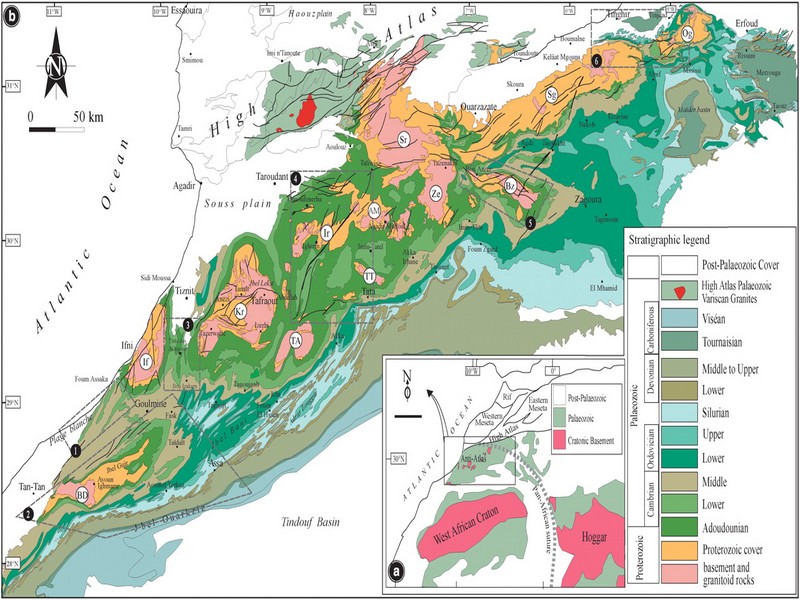
Geology of Morocco has been subdivided into four structural domains, from north to south they are the following: the Rif domain, the Meseta domain, the High Atlas, and the Anti-Atlas, as they are shown in (Figure 1).
The Rif Range extends along the Mediterranean coast from the Kabylian-Tellian belts up to the Strait of Gibraltar. South of it, the Meseta domain is located, where elevated plateaus and intramontane basins occur. Further south the High Atlas system is found, which displays several massifs close to 4000 m, including the highest peak of northern Africa (Jebel Toubkal). The Middle Atlas represents a branch of the Atlas system that extends obliquely across the Meseta domain, and exceeds 3000 m in elevation. Finally, the Anti-Atlas domain is found, which rises forming a massive mountain that achieves up to 2700 m. Further south the elevation decreases both southward and westward from ca. 1000 m to less than 200 m close to the Atlantic.

Figure 1: Elevation map of Morocco and neighbouring countries from GTOPO30 database (A. Michard et al. 2008)
GEOLOGICAL SETTING OF THE ANTI-ATLAS
The Anti-Atlas mountain belt is located in the northern part of the West African Craton (WAC). It is stretching NE-SW and is characterized by Precambrian to late Proterozoic rocks covered by younger sediments of Edicaran to Cambrian in age. The geological boundary between the Anti-Atlas and High Atlas is structurally marked by the South Atlas fault (SAF) (Fig.2). The Anti-Atlas massif is a zone of wide domal uplift with much weaker Alpine age deformation. The volcanics and conglomerates rocks from the Ouarzazate & Bou Salda group in the North-East are surrounding the older volcanics rocks
The Anti-Atlas mountain belt is located in the northern part of the West African Craton (WAC). It is stretching NE-SW and is characterized by Precambrian to late Proterozoic rocks covered by younger sediments of Edicaran to Cambrian in age. The geological boundary between the Anti-Atlas and High Atlas is structurally marked by the South Atlas fault (SAF) (Fig.2). The Anti-Atlas massif is a zone of wide domal uplift with much weaker Alpine age deformation. The volcanics and conglomerates rocks from the Ouarzazate & Bou Salda group in the North-East are surrounding the older volcanics rocks and turbidite sequences from the Sahgro Group and the Pan-African granite intrusions. This geomorphological feature is commonly called inliers (“boutonnière” in French) and is the result of an exposed older rock formation surrounded by younger rock, and is due to a high erosion rate of rocks with different hardness but also encouraged by deformation such as folding and faulting (Gasquet et al. 2005). Several slivers of ophiolites are present in the Anti-Atlas belt, the best preserved are situated in the Bou Azzer, Siroua and Iriri region, which represent remnant of an ocean closure. The basement is composed of schists, granites and mylonites of Paleoproterozoic age. The latest Variscan and Alpine orogenic events overprint most of the Anti-Atlas geological province and thus complicate the Pre- Cambrian geodynamic interpretation. However, two main periods of tectono-thermal magmatic activity (Gasquet et al. 2005) are now recognised :
(i)A Palaeoproterozoic period, corresponding to the Eburnean (Birimian) orogeny,
(ii)A Neoproterozoic period, corresponding to the Pan-African orogeny.

Figure 2: Schematic map of the Anti-Atlas Precambrian inliers (Boutonnière), and location of the maps, satellite views and lithospheric profile presented hereafter (Gasquet et al. 2008)
Source web : DR.Hervé Rezeau, DR.Cyril Chelle-Michou & DR.Michael Calder unige.ch
Les articles en relation

La Nasa envisage de coloniser Vénus avec des dirigeables
La Nasa envisage de coloniser Vénus avec des dirigeables L'idée semble folle mais elle ne l'est pas. Vénus serait plus facilement colonisable que Mars sous forme de mini-biosphères flottant à
Savoir plus...
Ahwach: Vers une reconnaissance en tant que patrimoine immatériel
Ahwach: Vers une reconnaissance en tant que patrimoine immatériel Baroud d'honneur pour le Festival national des arts d’Ahwach qui s'est tenu à Ouarzazate du 10 au 12 août. Une 6e édition qui
Savoir plus...
Au nord du jbel Bani (Préhistoire et Jbel Bani)
Site de Lghola En bas de la grande descente du Tizi Guettara par l’oued Feija, après un ressaut, arrivée dans une zone de tumulus. L’ensemble domine la grande plaine qui relie Zagora à Foum Zguid. Sur
Savoir plus...
La tarification du carbone progresse mais l’atteinte des objectifs de l’accord de Paris exige des mesures plus radicales, selon un nouveau rapport de la Banque mondiale
La tarification du carbone progresse mais l’atteinte des objectifs de l’accord de Paris exige des mesures plus radicales, selon un nouveau rapport de la Banque mondiale Huit nouvelles initiatives de tarification du carbon
Savoir plus...
Paléontologie : De nouvelles trouvailles à Fezouata
Paléontologie : De nouvelles trouvailles à Fezouata Les formations géologiques de Fezouata, situées au nord de Zagora, ont révélé de nouveaux trésors archéologiques. Le 1
Savoir plus...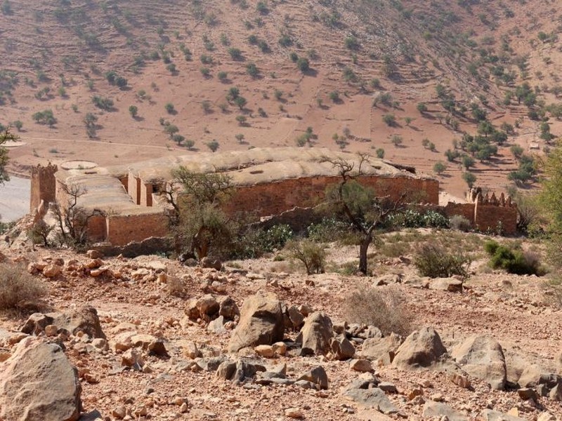
Visite hier de l’Agadir Inoumar
Visite hier de l’Agadir Inoumar Nous voulions faire découvrir à ma soeur Régine et à Georges un grenier fortifié de l’Anti-Atlas. Celui d’Imchguiguilne étant toujours fer
Savoir plus...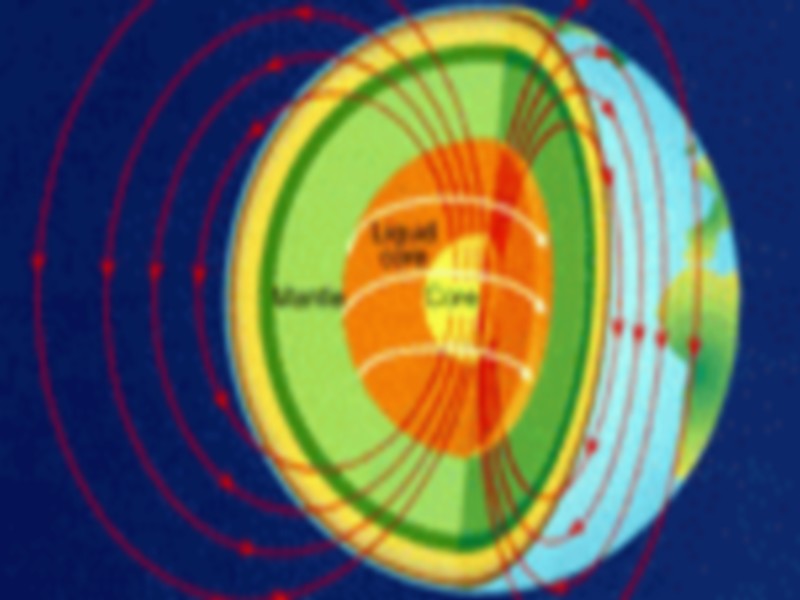
Les sept couches de la terre
Quand les scientifiques ont commencé à explorer les profondeurs de la terre et à fournir les efforts pour connaître les secrets de sa structure et de sa composition, ils ont constaté que les mythes qui
Savoir plus...
Les défis à relever pour un artisanat tourné vers l'avenir...
Les défis à relever pour un artisanat tourné vers l'avenir... Pour faire face à cette situation de crise, le secteur de l'artisanat et ses différents acteurs doivent relever plusieurs d&eacu
Savoir plus...
Icht, village troglodytique de l’Anti-Atlas : un tresor historique entre oasis, ksar et gravures rupestres
Icht, village troglodytique de l’Anti-Atlas : un tresor historique entre oasis, ksar et gravures rupestres Niché au pied du Jbel Bani, dans le sud du Maroc, Icht est l’un des villages les plus singuliers de l&rsquo
Savoir plus...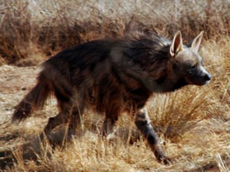
La Hyène rayée
La Hyène rayée Issue du genre « Hyaena », la Hyène rayée fréquente les régions sèches ou désertiques. On la trouve notamment dans la région du bas Drâa
Savoir plus...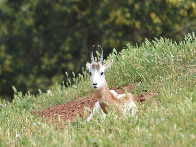
La diversité génétique: un défi à relever pour une Conservation réussie des antilopes
La diversité génétique: un défi à relever pour une Conservation réussie des antilopes Au Jardin Zoologique National, une nouvelle conférence sur la thématique de la Conservation
Savoir plus...
Circuit 8 jours au départ et retour vers Guelmim
Circuit 8 jours au départ et retour vers Guelmim Circuit de 8 jours Circuito en 8 dias - Circuit in 8 days Piste 4x4 Jour 1 - Départ Guelmim - Taghjijt - Ifrane - Amtoudi Jour 2 - Tafraoute Jour
Savoir plus...Les tags en relation
En savoir plus sur " Géologie et TSGJB - AMDGJB "
Consulter les vidéos de " Géologie et TSGJB - AMDGJB " Consulter les photos de " Géologie et TSGJB - AMDGJB " Consulter les publications de " Géologie et TSGJB - AMDGJB " Consulter les éditions de " Géologie et TSGJB - AMDGJB " Consulter les communications de " Géologie et TSGJB - AMDGJB "Recherche du site
Recherche avancée / Spécifique
Géoparc et Recherche Scientifique
Le coins de l’étudiant


Blog Géoparc Jbel Bani
Dictionnaire scientifique
Plus de 123.000 mots scientifiques
Les publications
Géo parc Jbel Bani

Circuits & excursions touristiques

cartothéques


Photothéques
Publications & éditions

