


STRUCTURAL EVOLUTION OF THE ANTI-ATLAS DOMAIN :AN OVERVIEW pour Yves Missenard
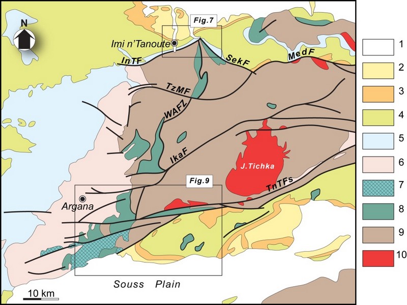
The Anti-Atlas represents the most important segments of the major Pan-African (≈0.5Ga) belt system of North Africa. This orogen exposed in a series of sporadic SW–NEtrending outcrops over 700km across southern Morocco, and reach ≈150km wide in the central part, west of Ouarzazate (Figure G1 & G2).Scattered outcrops of related rocks are described in NW Algeria which indicate that the belt continues from SE Morocco southeastwards with a NW–SEtrend.
The Anti-Atlas orogen comprises two main sequences of rocks: a metamorphic basement of Palaeoproterozoic (2Ga) age and the Neoproterozoic rocks. The Palaeoproterozoic rocks form the northern margin of the West African Craton mainly outcropping in the Reguibate Shield in Mauritania And Algeria. The Palaeoproterozoic basement is exposed in a series of uplifted inliers (‘‘boutonnieres’’) surrounded by the Neoproterozoic rocks that were locally deformed with the basement during the Pan African Orogeny. with the during the Pan African Orogeny.
Paleoproterozoic rocks and Eburnian orogeny
The oldest rocks of Morocco, Archean in age3 Ga(Montero et al, 2014) crop out in the southernmost Reguibat E shield which formsthe northern part the West African Craton (WAC).Further north, in the Anti-Atlas chain, the basement units are Paleoproterozoic (Taznakht Group, former” PI”)cropping only in the south of the Anti-Atlas Major Fault (AAMF). They are metamorphic rocks (greenschist to amphibolite facies) intruded by peraluminous and calc-alkaline granitoids dated around 2Ga(Thomas et al, 2002).The corresponding tectono-magmatic and metamorphic events are assigned to the Eburnian/Birimian orogeny.
Neoproterozoic rocks and Pan-African orogeny
As everywhere in the WAC, Mesoproterozoic rocks are lacking in the Anti-Atlas. Neoproterozoic Formations overlie directly the Paleoproterozoic basement. The Neoproterozoic/Paleoproterozoic boundary is generallya tectonic contact (thrust, strike-slip or detachment faults), and seldom a stratigraphic contact (Tizi n’Taghatine). Globally, the Neoproterozoic formations record three main stages of the Pan-African cycle (figureG4):
I .The early Neoproterozoic platform development is marked by the accumulation of thousands of meters of quartzites and stromatolitic limestones (Taghdoute Group, former “PII”), intruded by doleritic dykes and gabbroic intrusions. These rocks are associated with the rifting of the WAC margin, broadly contemporaneous with the oceanic accretion further north (760 Ma), witnessed along the AAMF by the Bou Azzer-El Graara and Siroua ophiolitic sequences (Bou Azzer Group).
II .Oceanic closure and subsequent Pan-African collision are associated with oceanic subduction along the northern margin of the WAC, ending with the accretion of oceanic arc formations (figureG4).The reported “blueschist facies” mineral associations in the Bou Azzer inlier are controversial. The polarity of the subduction remains also matter of debates; the same is true for the real location of the northern edge of the WAC. The oblique Pan-African collision(655 Ma to 640 Ma) generated south-verging thrust sheets onto the cratonic margin. South of the AAMF, the main Pan-African phase is recorded by low grade recrystallizations, synmetamorphic folds and various ductile and brittle structures in the Taghdout Group series.
III The Late to Post Pan-African extensional event is recorded by the extensive volcanic and volcano clastic series of the Ouarzazate Group (former “PIII”, 580 Ma to 560Ma), interbedded with subaerial to lacustrine deposits, which unconformably overlie the Eburnian and/or Pan-African basement units. The Ouarzazate Group shows abrupt variations of thickness and facies controlled by extensional tectonic activity. Various high-K calc-alkaline to alkaline plutons emplaced within the Ouarzazate Group, coeval with the volcanic rocks of comparable chemistry.

FigureG4: Generalized lithostratigraphic column for the Anti-Atlas Pan-African orogen. “PI” = “XI”, etc. are the classical stratigraphic symbols used on Anti-Atlas geological maps. HKCA: High-K calc-alkaline (granitoids) after Thomas et al. (2004), Gasquet et al. (2005) and Liégeois et al.2006 in Youbi et al., 2013

Source web par sociedadgeologica.es
Les articles en relation

Climat : un coup de froid sur l'Europe dans les décennies à venir ?
Climat : un coup de froid sur l'Europe dans les décennies à venir ? L'ONU estime qu'il y a peu de chance que les objectifs de la COP 21 soient atteints et que le réchauffement climatique se restreigne
Savoir plus...
Chute des spéléologues espagnols : Intox anti-marocaine dans les médias ibériques (Géoparc Jbel Bani)
Chute des spéléologues espagnols : Intox anti-marocaine dans les médias ibériques (Géoparc Jbel Bani) Face à des allégations médiatiques attribuant aux secours espagnols le m&ea
Savoir plus...
Ce Maroc que les touristes connaissent mieux que nous ! (Géoparc Jbel Bani)
Ce Maroc que les touristes connaissent mieux que nous ! (Géoparc Jbel Bani) Au Maroc, il existe des destinations rarement mentionnées dans les guides touristiques et que seuls quelques initiés fréquentent.
Savoir plus...
Zagora ...Sport et Loisir à Draa
Zagora ...Sport et Loisir à Draa Trek et Randonnée dans le désert Découvrirez la magnifique vallée de Draa ses palmeraies les paysages somptueux du désert du sud marocain, au ryt
Savoir plus...
Les folklores de Zagora: un patrimoine immatériel de haute valeur artistique
Les folklores de Zagora: un patrimoine immatériel de haute valeur artistique La population des oasis de la vallée du Draa moyen, Sud Est marocain, se caractérise par une grande diversité ethnique (Draoua,
Savoir plus...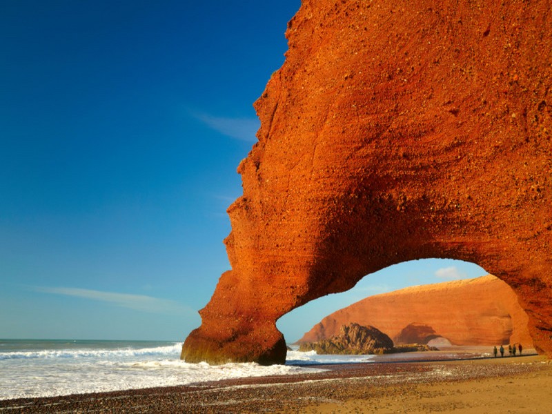
Monument : L’arche de Legzira n’est plus
Monument : L’arche de Legzira n’est plus Alors qu’elle figurait sur toutes les brochures touristiques, l’une des principales arches rocheuses de la plage de Legzira, près de Sidi Ifni, s’est r&eac
Savoir plus...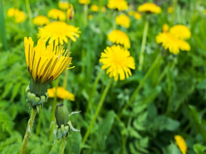
Ortie, pissenlit : les bienfaits des mauvaises herbes
Ortie, pissenlit : les bienfaits des mauvaises herbes Elles encombrent votre jardin, poussent dans la pelouse, entre les dalles de la terrasse ou contre les murs : ne jetez pas toutes les mauvaises herbes, certaines comme l
Savoir plus...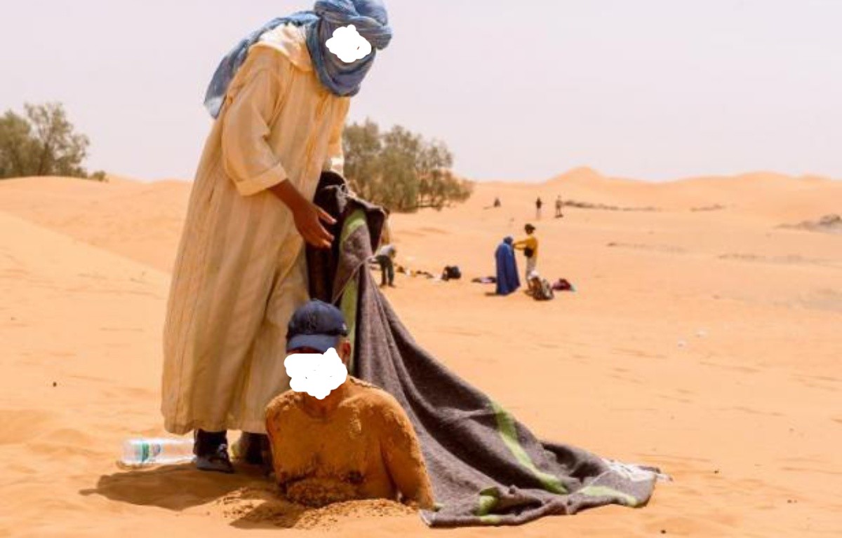
Sablo-thérapie :Zagora - l'été des bains de sable au Sud marocain
Sablo-thérapie :Zagora - l'été des bains de sable au Sud marocain Le bain de sable votre médecin naturel Zagora vous présente des étendues de sable brulant aperte de vue, c'est la ou
Savoir plus...
épizootie
Épizootie Une épizootie est une épidémie qui touche des animaux de la même espèce ou d'espèces différentes, dans une région donnée. Tout comme pour une é
Savoir plus...
Les éclipses de Soleil ont permis de grandes découvertes scientifiques
Les éclipses de Soleil ont permis de grandes découvertes scientifiques Depuis plus de 2.000 ans, les éclipses de Soleil ont permis des bonds de géant en astronomie. Par des méthodes astucieuses, des
Savoir plus...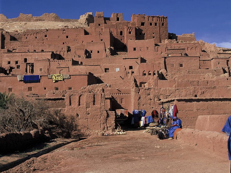
Ksar d'Aït-Ben-Haddou
Ksar d'Aït-Ben-Haddou Ensemble de bâtiments de terre entourés de murailles, le ksar est un type d'habitat traditionnel présaharien. Les maisons se regroupent à l'intérieur de ses mur
Savoir plus...Les tags en relation
En savoir plus sur " Géologie et TSGJB - AMDGJB ! "
Consulter les vidéos de " Géologie et TSGJB - AMDGJB ! " Consulter les photos de " Géologie et TSGJB - AMDGJB ! " Consulter les publications de " Géologie et TSGJB - AMDGJB ! " Consulter les éditions de " Géologie et TSGJB - AMDGJB ! " Consulter les communications de " Géologie et TSGJB - AMDGJB ! "Recherche du site
Recherche avancée / SpécifiqueVulgarisation à la géologie
Qu'est ce que les sciences de la terre: vulgarisation Qu'est ce que la géologie ? Géologie et TSGJB - AMDGJB !
Géoparc et Recherche Scientifique
Le coins de l’étudiant


Blog Géoparc Jbel Bani
Dictionnaire scientifique
Plus de 123.000 mots scientifiques
Les publications
Géo parc Jbel Bani

Circuits & excursions touristiques

cartothéques


Photothéques
Publications & éditions

