

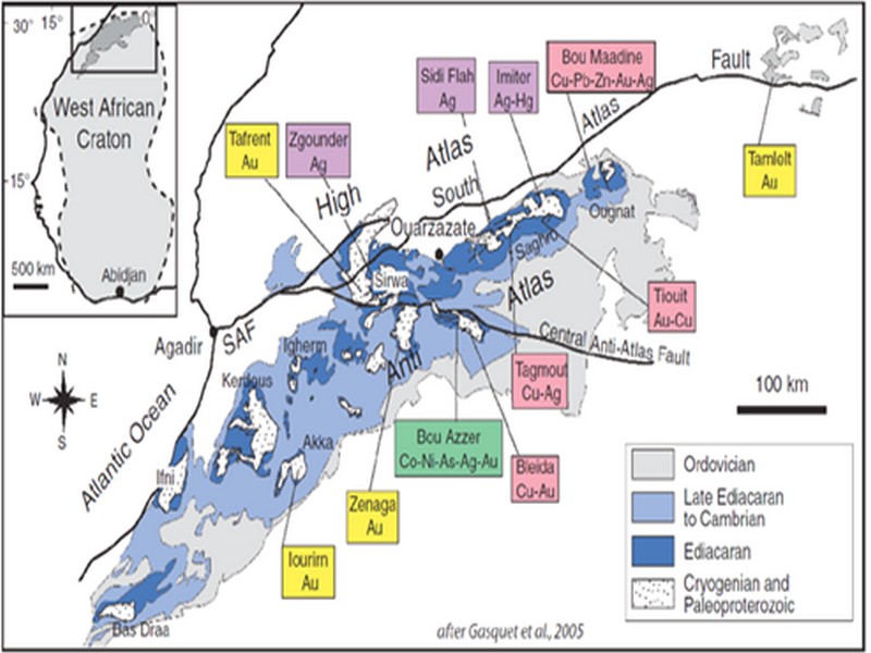

ORE DEPOSITS IN THE ANTI-ATLAS AND SUB-ATLAS REGIONS
The Anti-Atlas geological province is the host of a variety of ore deposits, ranging from Paléoprotérozoïque to Ordovician in age. These deposits are mainly Cu-Au porphyry types, precious metal epithermal (Au, Ag) or polymetallic VMS base metals (Cu, Pb, Zn, Au, and Ag), while the sub- Atlas region presents an important occurrence of manganese. Figure 8 shows the location of the most important deposits in the Anti-Atlas region.
Located in eastern Anti-Atlas, the world class Imiter Ag-Hg mine (8.5 Mt at 700g/t Ag), is among the most important deposits in Morocco. It is considered to be of epithermal origin. The silver mineralisation happened during regional extension (+/- transpession?) tectonic regime event around 550 and is hosted in a series of volcanic felsic rocks Ma (Tuduri et al, 2006). Briefly, a three-stage model has been proposed to explain the deposit: a first episode characterized by the development of quartz, pink dolomite, and Ag-rich minerals veins formed during a dextral transpressive event, followed by a barren stage associated with a normal left-lateral motion that re-opened previous structures, and a final alteration stage (i.e. supergene enrichment) that contributed to local enrichment in Ag deposit (Tuduri et al, 2006).
Regarding copper, Bleida was the most important Cu deposit of northern Africa until late 90’s. Located on the northern edge of the West African Craton, the Bleida orebodies are located on an inactive continental margin along with preserved ophiolites of Upper Proterozoic age. The copper deposits (chalcopyrite, bornite, pyrite) are stratiform distal massive sulfide bodies whose position is controlled by both the sedimentation of shales and an acid volcanism, which follows a more important basic volcanism. Pan-African deformation (650-600 Ma) has determined the current geometry of the cupriferous lenses although it has not remobilized the sulfides out of their original carrier beds (Leblanc and Billaud, 2006). West of the main Moroccan Bleida copper deposit, gold mineralization has also been discovered (West Bleida, ca. 3 tonnes metal Au). It is hosted by metamorphosed and deformed mafic to intermediate volcanic rocks that are part of the Neoproterozoic tholeiitic volcano-sedimentary series forming the stratigraphically upper part of the Bou Azzer ophiolite sequence. Gold mineralization primarily occurs
as deformed gold-bearing quartz veins and disseminations in Cu-rich chert zones (chalcopyrite– malachite), Fe-rich lithofacies and breccia zones. Gold is accompanied by small amounts of copper sulphides (<1% modal chalcopyrite).
Another important occurrence (not displayed in the map, Fig. 8) is the Imini Manganese deposit, the most important Mn deposit of Morocco, located in the western margin of the Ouarzazate foreland basin (Sub-Atlas). The manganese ore is made of pyrolusite (MnO2), and is hosted in different horizons of dolomites from the lower Cretaceous, and another accessory layer. This layers thickness can reach up to 1 meter. The deposit scale is 25 km per 100-400 m width, and sits above slates and crystalline rocks. Dolomitic sandstone and/or conglomerate are present between each mineralized horizon. Isabel von Steinaecker; source: http://www.geo.tu-freiberg.de/oberseminar/os03_04/Isabel_Steinaecker.pdf).

Figure 8: The Anti-Atlas belt at the northern limit of the West African Craton. Redrawn after Dallmeyer and Lecorché (1991) and a geological sketch map of the Anti-Atlas belt in southern Morocco and location of main ore deposits. SAF: South Atlas Fault. Gasquet and al. (2005)
Source web par unige.ch
Les articles en relation
L'art préhistorique en 5 images exceptionnelles
Au cours du Paléolithique supérieur (période qui débute vers 30.000 av. J.-C.), les Hommes éprouvent le besoin de représenter leur quotidien et d'exprimer leurs émotions. Prése
Savoir plus...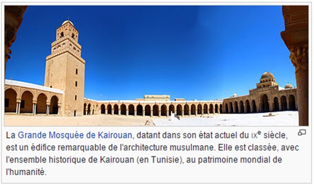
Patrimoine architectural
Patrimoine architectural Le patrimoine architectural est l'ensemble des constructions humaines qui ont une grande valeur parce qu'elles caractérisent une époque, une civilisation ou un&n
Savoir plus...
Champagne-Ardenne & Région de l’Oriental : pour une coopération efficace incluant la valorisation du patrimoine pour Jean-Paul BACHy
Champagne-Ardenne & Région de l’Oriental : pour une coopération efficace incluant la valorisation du patrimoine pour Jean-Paul BACHy Monsieur Jean-Paul BACHy Président de la Région Champagne
Savoir plus...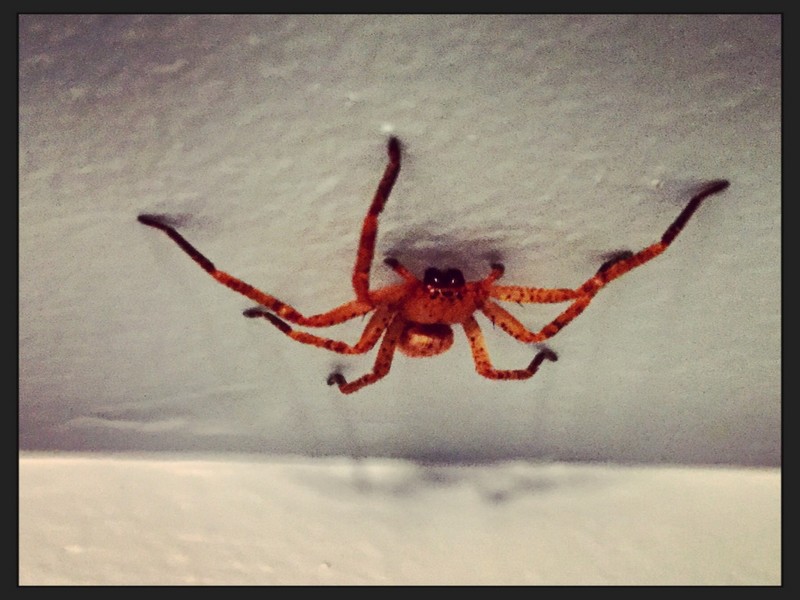
Les araignées les plus dangereuses et les plus venimeuses du monde
Les araignées les plus dangereuses et les plus venimeuses du monde 1. L’araignée banane Les scientifiques à cette araignée le nom de Phoneutria nigriventer, elle mesure environ 10 centimètr
Savoir plus...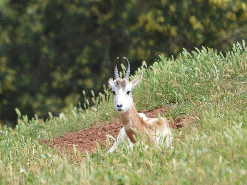
La diversité génétique: un défi à relever pour une Conservation réussie des antilopes
La diversité génétique: un défi à relever pour une Conservation réussie des antilopes Au Jardin Zoologique National, une nouvelle conférence sur la thématique de la Conservation
Savoir plus...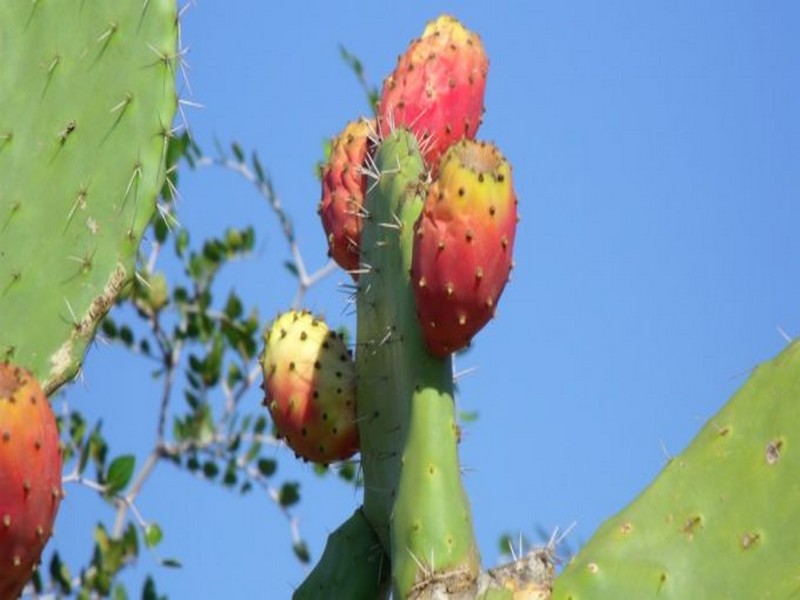
FAO: Pourquoi le cactus devrait être une "culture essentielle" au Maroc
FAO: Pourquoi le cactus devrait être une "culture essentielle" au Maroc Durant les périodes de sécheresse ou dans les zones arides, le cactus et la figue de Barbarie devraient constituer un atout pr&eacu
Savoir plus...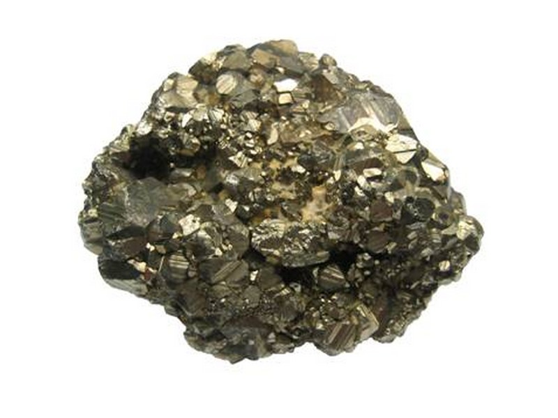
Les Minéraux
Qu'est ce qu'un minéral ? Un minéral est caractérisé par le fait qu'il est constitué d'une seule espèce chimique, c'est à dire que c'est un corps pur. En g&eacu
Savoir plus...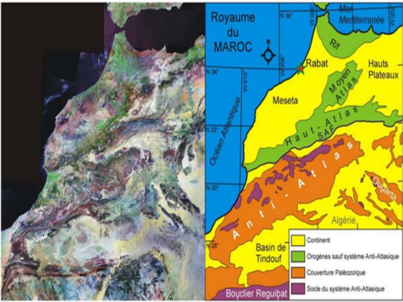
Situation géographique et bases géologiques pour Charles Robert-Charrue
Situation géographique et bases géologiques pour Charles Robert-Charrue Au Nord-ouest du continent africain, l’Anti-Atlas constitue le domaine austral du Royaume du Maroc. Comme le suggère l’image sat
Savoir plus...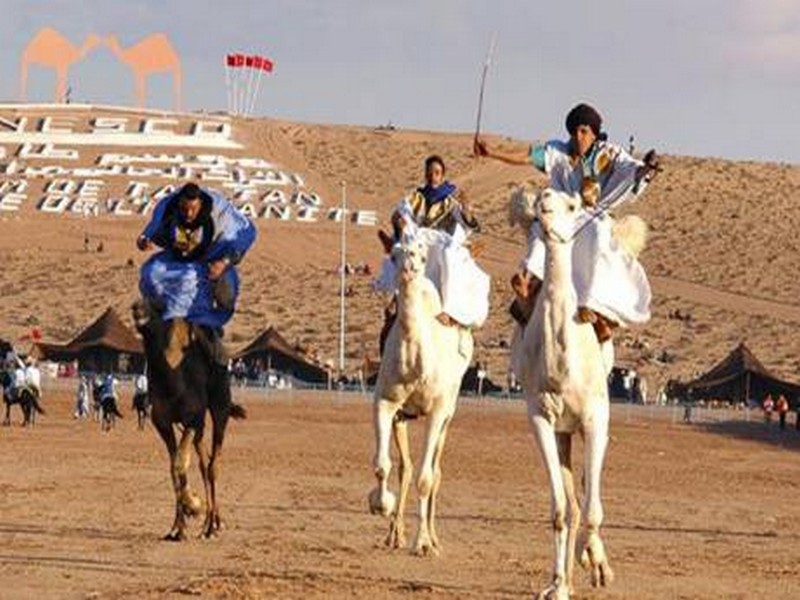
Moussems et Féstivals
Moussems et Féstivals Moussems et fêtes traditionnelles au Maroc : Moussems, fêtes musulmanes ou familiales, les festivités marocaines égrènent les saisons, rompent la monotonie quotidienne
Savoir plus...
Défense de l'Environnement- Partenaires - durabilité
La défense de l’environnement ne s’arrête pas à nos frontières Les problèmes environnementaux n’ont pas de frontières. La destruction de la biodiversité ou le changeme
Savoir plus...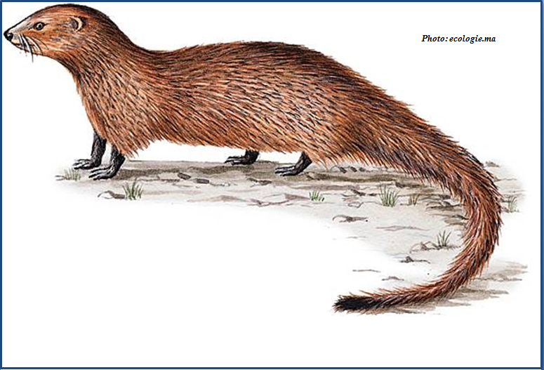
La mangouste Ichneumon (نمس)
La mangouste Ichneumon (نمس) Le rat des pharaons (Herpestes ichneumon en latin, نمس en Darija ), mangouste d’Égypte ou mangouste ichneumon est une espèce de petit mammifère carnivore, qui depuis touj
Savoir plus...Les tags en relation
En savoir plus sur " Géologie et TSGJB - AMDGJB ! "
Consulter les vidéos de " Géologie et TSGJB - AMDGJB ! " Consulter les photos de " Géologie et TSGJB - AMDGJB ! " Consulter les publications de " Géologie et TSGJB - AMDGJB ! " Consulter les éditions de " Géologie et TSGJB - AMDGJB ! " Consulter les communications de " Géologie et TSGJB - AMDGJB ! "Recherche du site
Recherche avancée / SpécifiqueVulgarisation à la géologie
Qu'est ce que les sciences de la terre: vulgarisation Qu'est ce que la géologie ? Géologie et TSGJB - AMDGJB !
Géoparc et Recherche Scientifique
Le coins de l’étudiant


Blog Géoparc Jbel Bani
Dictionnaire scientifique
Plus de 123.000 mots scientifiques
Les publications
Géo parc Jbel Bani

Circuits & excursions touristiques

cartothéques


Photothéques
Publications & éditions

