


Jebel el Kest: A stunning day in the Moroccan Anti-Atlas
The ascent of Jebel el Kest in Morocco’s Anti-Atlas is a stunning day in remote mountains – one of the very best hill days. Cicerone’s Publisher, Jonathan Williams, explored the area with his son Joe in February 2015..
‘Anergui...’ Chris Bonington’s always-quiet tone dropped a notch as he repeated the name, his eyes seeming to glaze over as though he was remembering big mountains in great ranges. I was impressed. All I’d done was mention this particular approach to the little-known Jebel el Kest in Morocco’s Anti-Atlas. It must be quite a hill. There was clearly a lot to look forward to on our walking and scrambling trip. Over the last twenty years the Anti-Atlas has grown into a remarkable arena for climbers. Massive amounts of rock at good climbing grades, easy access, good prices and great people have all made this area a new home-from-home for a generation of climbers: Les Brown, Joe Brown, Chris Bonington, Claude Davies... all well-known names on the friendly streets of Tafraoute.
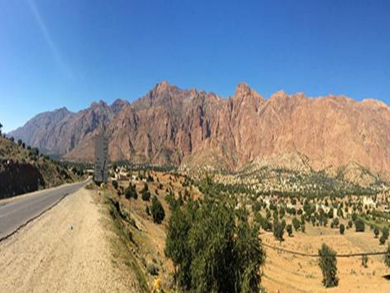
A town of 5000 people, Tafraoute is set off to the south of Jebel el Kest, giving it astonishing views to the quartzite range that glows bright pink in the evening light. It’s located in an area the maps refer to as ‘The Granite Area’, full of piles of strangely shaped boulders. There are several hotels and a few restaurants, plenty of shops, pharmacies, a weekly souk, and a small medical centre (with which we had dealings the next day – another story). The French influence is unmistakable; well taught in the schools it’s one of three languages – with Arabic and Berber – spoken throughout Morocco. Those involved in adventures and other trading all have excellent French and a surprising amount of English. And catering to climbers is only one of Tafraoute’s enterprises. It’s a stop-off for the many French who tour around Morocco and into the Sahara, often in sizeable motor homes. This has led it to its development as a major centre for carpet selling, and the two emporia that service this business have become masters of the art. It’s unlikely your resistance is even close to a match for their sales talents, so it’s best just to embrace it. Tafraoute is as a fine place as any to buy a carpet, rug or throw and it will make a valuable contribution to the local economy.
Located about 3 hours’ drive south east of the Atlantic resort of Agadir, a 4-hour flight from the UK, this remote area on the edge of the Sahara desert can be reached inside a day. The drive down is fascinating – remarkably little traffic but a whole new culture with shepherds and flocks crossing the road, towns and Berber villages large and small, roadside water stalls, women in niqab and hijab of all colours, minarets and wild mountain scenery, as well as the inevitable game of chicken as two vehicles pass on the road eroded by the perpetual sun and occasional rain down to a singe track. Winter temperatures are ideal for walking, but the main season is March to April and October into November. In mid-February we had cloudless days up to 20º and night-time temperatures of 8 to 10º – fine Cumbrian summer days.
Jebel el Kest itself is just the highest point in a long and complex ridge extending over 35km and accessible from both north and (more usually) south. There are a few paths – original Berber shepherd trails above the villages – but much of it is trackless. And everything up there is either sharp or spikey.
Pub in May 2015
Source web par cicerone-extra
Les articles en relation
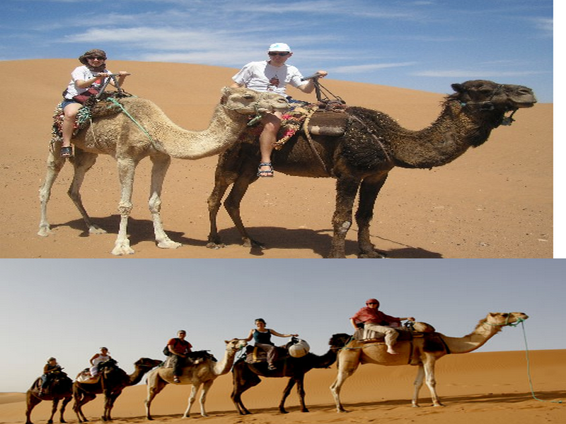
Le dromadaire marocain
Dans certaines régions, il est encore utilisé comme un moyen de locomotion. Ses poils quand ils tombent lors de sa mue annuelle servent à fabriquer des tapis et des vêtements. Le lait de dromadaire bien plus r
Savoir plus...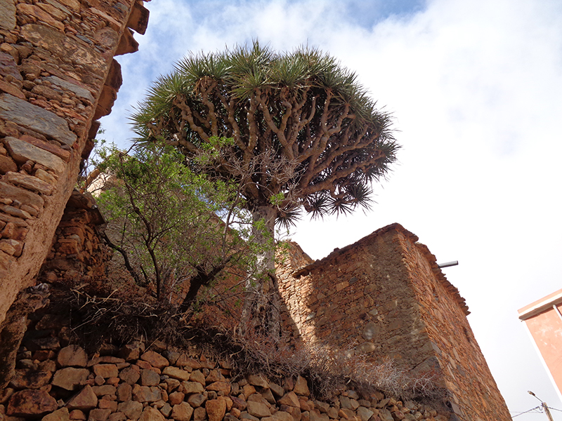
LE DRAGONNIER, UN ARBRE MYTHOLOGIQUE
LE DRAGONNIER, UN ARBRE MYTHOLOGIQUE Dans l’antiquité, les personnages de la mythologie grecque évoluaient, au gré de leur destin, d’un bout à l’autre du bassin méditerranée
Savoir plus...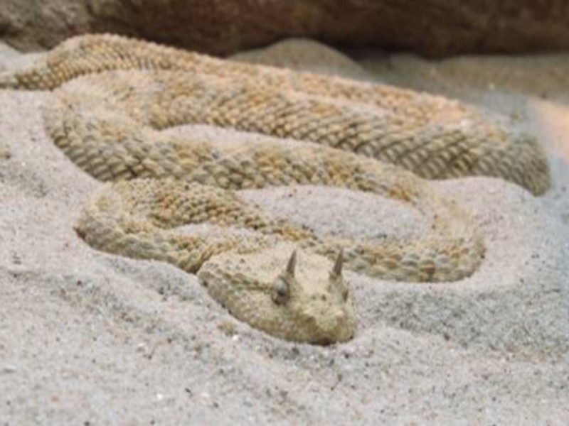
La vipère à cornes
La vipère à cornes (Cerastes cerastes) est un serpent qui appartient à la famille des «Viperidae ». Elle vit dans les déserts d’Afrique du nord et du Moyen-Orient. Elle doit son nom aux d
Savoir plus...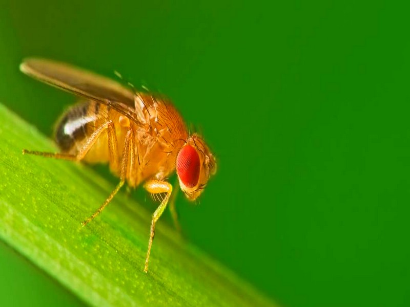
Ce que cache le cerveau d’une mouche
Ce que cache le cerveau d’une mouche Pour les non-initiés, cela ne ressemble pas à autre chose qu'à un arc-en-ciel de fils entremêlés. Mais pour les neurologues, il s'agit là d&#
Savoir plus...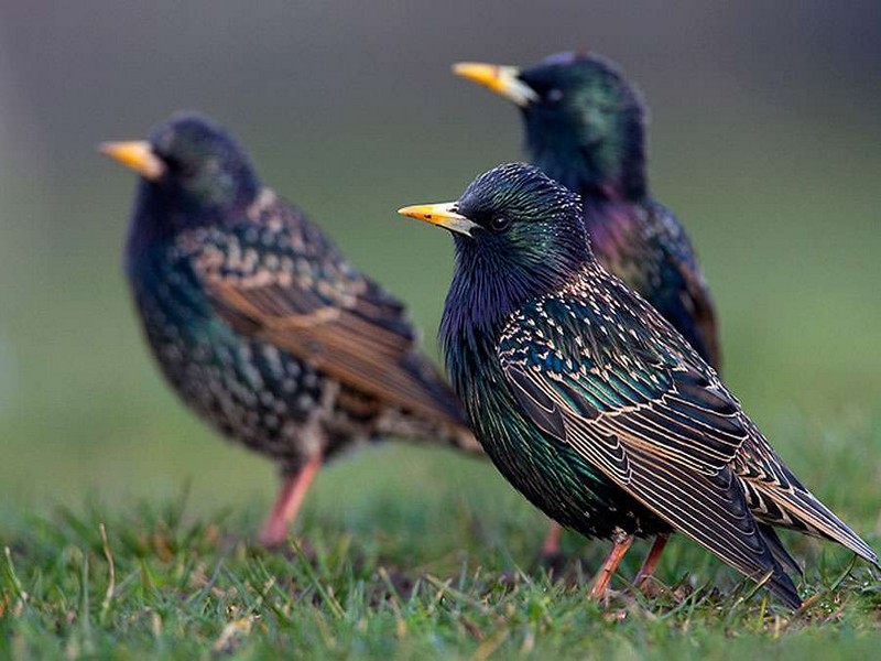
Nuées d'étourneaux : comment coordonnent-ils leurs vols ?
Nuées d'étourneaux : comment coordonnent-ils leurs vols ? Les étourneaux, et d'autres oiseaux se comportent souvent comme une unité, formant une nuée, filant parfois dans une direction pr&ea
Savoir plus...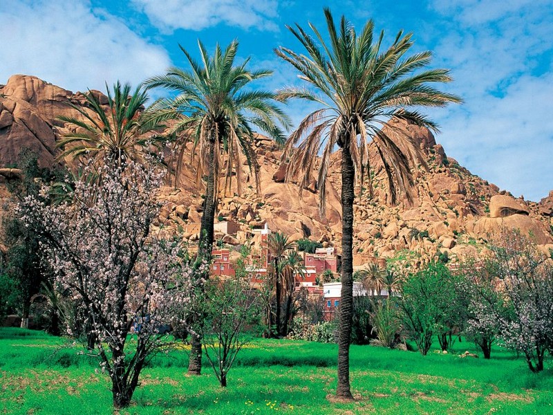
Vallées de l'Anti-Atlas - Spécial amandiers en fleur (Géoparc Jbel Bani)
Vallées de l'Anti-Atlas - Spécial amandiers en fleur (Géoparc Jbel Bani) Cet itinéraire permet de découvrir un Maroc encore secret fait de montagnes arides et de villages qui semblent vivre hors
Savoir plus...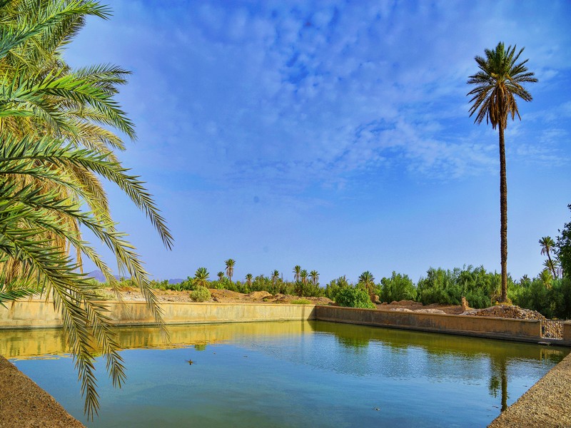
TATA
TATA LES PORTES DU DÉSERT Tata est une terre de richesse et de partage qui s’explore avec le cœur et l’hospitalité y est profondément enracinée. Au-delà de ses paysages natur
Savoir plus...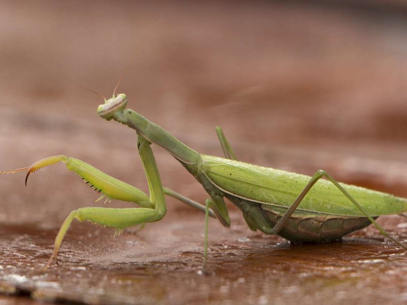
Vie sexuelle des mantes religieuses : elle le décapite puis se reproduit avec !
Vie sexuelle des mantes religieuses : elle le décapite puis se reproduit avec ! La mante religieuse est connue pour sa tendance à dévorer ses partenaires sexuels. Mais saviez-vous que, même décapit&e
Savoir plus...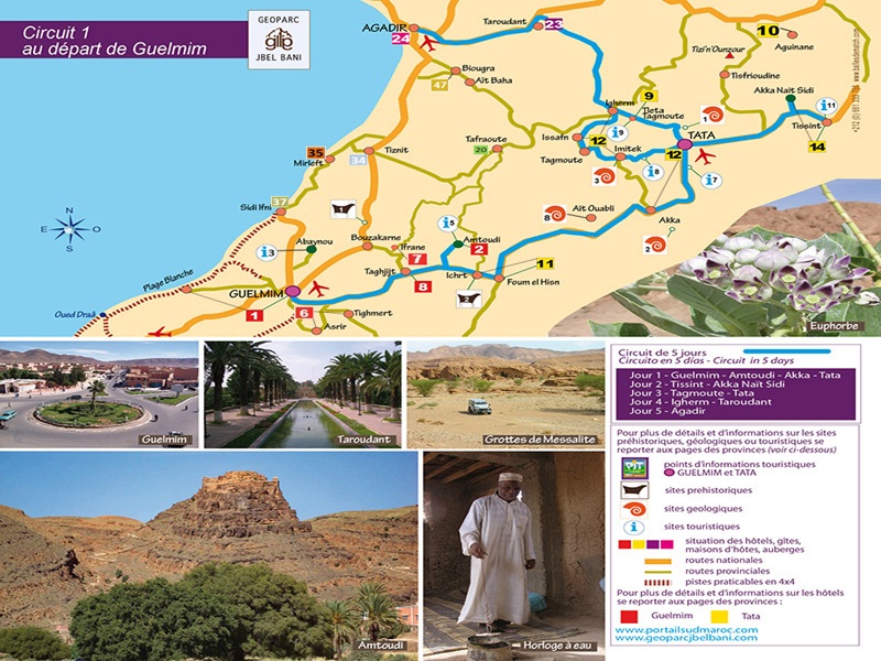
Circuit 5 jours de Guelmim vers Agadir-géoparc jbel bani
Circuit 5 jours de Guelmim vers Agadir-géoparc jbel bani Çircuit de 5 jours : Circuito en 5 dias - Circuit in 5 days Jour 1 - Guelmim - Amtoudi - Akka - Tata Jour 2 - Tissint - Akka Naït Sidi Jour
Savoir plus...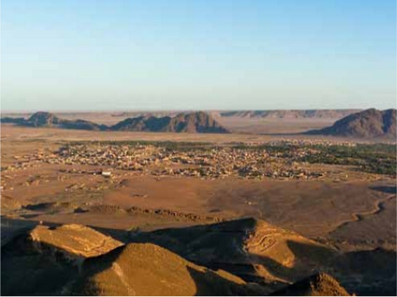
Un exemple d’analyse-étude, de requalification et sauvegarde du patrimoine culturel et architectural de l’oasis de Figuig
Un exemple d’analyse-étude, de requalification et sauvegarde du patrimoine culturel et architectural de l’oasis de Figuig Monsieur Maurizio CAFAREllI, Directeur du programme Restauration du patrimoine de l’Or
Savoir plus...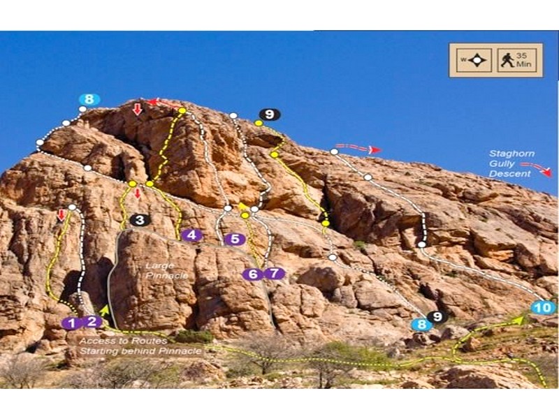
Morocco Rock - Jebel el Kest and Taskra North Overview Map (Géoparc Jbel Bani)
Morocco Rock - Jebel el Kest and Taskra North Overview Map (Géoparc Jbel Bani) Source web: climb-europe
Savoir plus...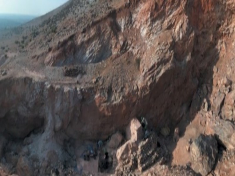
Le Maroc veut classer Jebel Irhoud parmi les sites archéologiques et historiques mondiaux
Le Maroc veut classer Jebel Irhoud parmi les sites archéologiques et historiques mondiaux Le Maroc travaille actuellement pour classer Jebel Irhoud (centre du Maroc), endroit où ont été découverts d
Savoir plus...Les tags en relation
En savoir plus sur " Montagnes et Anti Atlas "
Consulter les vidéos de " Montagnes et Anti Atlas " Consulter les photos de " Montagnes et Anti Atlas " Consulter les publications de " Montagnes et Anti Atlas " Consulter les éditions de " Montagnes et Anti Atlas " Consulter les communications de " Montagnes et Anti Atlas "Recherche du site
Recherche avancée / SpécifiqueMontagnes Jbel Bani, Jbel Kerst et Anti Atlas
Montagnes et Anti Atlas Caractéristiques des montagnes du Jbel Bani Jbel Bani et Jbel Kesrt
Géoparc et Recherche Scientifique
Le coins de l’étudiant


Blog Géoparc Jbel Bani
Dictionnaire scientifique
Plus de 123.000 mots scientifiques
Les publications
Géo parc Jbel Bani

Circuits & excursions touristiques

cartothéques


Photothéques
Publications & éditions

