


CENTRAL ANTI-ATLAS TRAVERSE: the northern border of the West African Craton
By DR. M. OUKASSOU, DR. H. EL HADI, DR. F. HAISSEN, DR. N. SABER
ITINERARY and OBJECTIVES
The south of Morocco is one of the most attractive touristic areas with diversified landscapes from snowy mountains to desert plains. The High Atlas with his 3000 to 4000 meters forms a major climatic barrier to the Atlantic perturbations, which account for the arid climate of the Anti Atlas sub Saharan domain south of the chain. These regions are occupied by berbere speaking populations with long hospitality tradition.
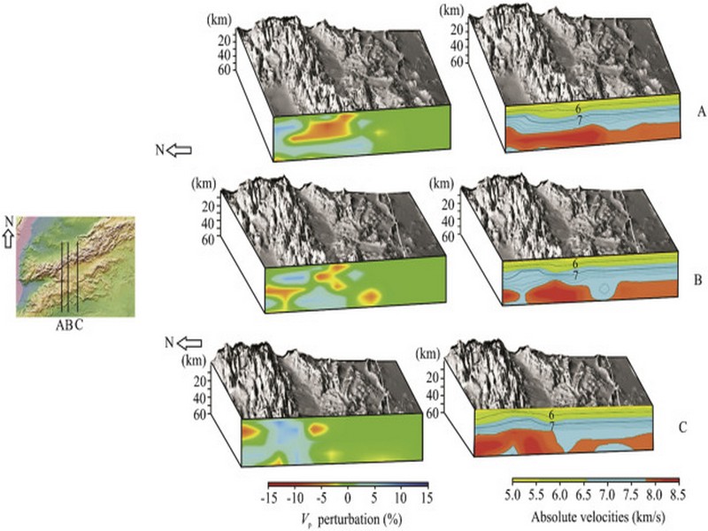
The two day trips follow most touristic roads and visit outstanding outcrops illustrating a central transect across the Anti-Atlas belt (figures G1 & G2), which corresponds to the external fold belt of the Hercynian (Variscan, Alleghanian) chain, but it also includes large Pan African inliers. The High Atlas formed during the Cenozoic at the expense of an aborted Triassic Jurassic rift. Therefore, three superimposed Wilsonian cycles can be illustrated during the trips. The itinerary will make possible to illustrate the complex geological history of these areas from 2 Ga to present day. Our purpose is to present and discuss various regional and thematic (sediment logical, structural, magmatic and
metamorphic) features, which record the main geodynamical events during this long geological history. Magnificent minerals (erhytrite, vanadinite...) and fossils (trilobites, goniatites...) can be purchased at many places.
During this field trip, the AgdzBou Azzer Tazenakht Agdzloop (figureG3)allows the participants to discover the PanAfrican belt (external platform domain in the Zenaga inlier, ophiolitic suture zone at Bou Azzer), the early volcano clastic cover sequence (late Neoproterozoic), and the mildly folded Early Paleozoic sediments (Cambrian and Ordovician).
Detailed road log for the trip are provided below along with Global Positioning Satellite (GPS) location at each stop. Note that all the stops are on public roads, and that the use of hammers and the collection of rocks are permitted.


Source web: DR. M. OUKASSOU, DR. H. EL HADI, DR. F. HAISSEN, DR. N. SABER sociedadgeologica.es
Les articles en relation
Comment sécuriser la ressource hydrique
Comment sécuriser la ressource hydrique Trois nouveaux axes en phase d’être déployés Priorité au dessalement et au recyclage des eaux usées La rareté de l’eau gagne p
Savoir plus...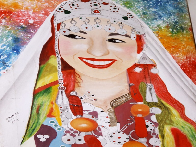
Entre rituel et institution, le mariage des Chlouh (Amazigh) au Géoparc Jbel Bani
Entre rituel et institution, le mariage des Chlouh (Amazigh) au Géoparc Jbel Bani Le mariage, « tangguift », au sein de la communauté chleuh – berbère, particulièrement célébr&e
Savoir plus...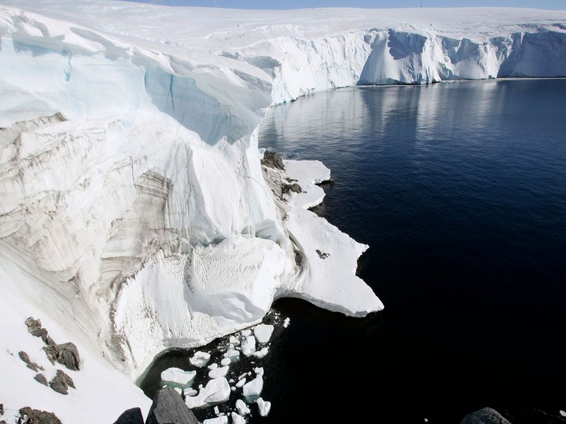
Antarctique: la découverte d'une nouvelle zone sismique inquiète les scientifiques
Antarctique: la découverte d'une nouvelle zone sismique inquiète les scientifiques L'éruption des volcans pourrait provoquer une importante fonte des glaces dans cette région déjà tou
Savoir plus...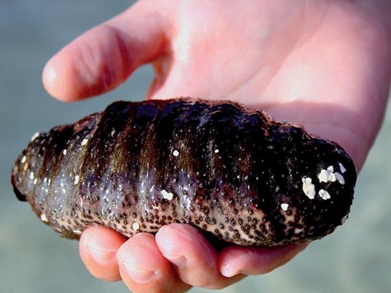
Dakhla: Menace sur le concombre de mer
La biodiversité de notre pays est mise à mal pour plusieurs raisons. Ce qui est encore plus inquiétant c’est l’apparition de nouvelles causes et conditions qui accentuent cette spirale infernale de
Savoir plus...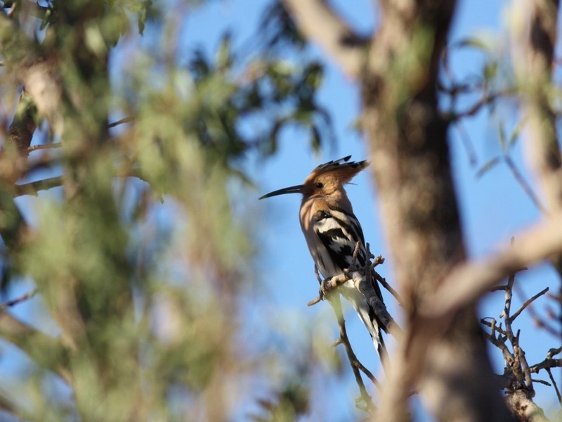
La huppe fasciée
La huppe fasciée La huppe fasciée est un oiseau au long bec gracile légèrement arqué. Il a une huppe érectile de plumes roussâtres au bout noir. Son dos est de couleur arlequin teint&ea
Savoir plus...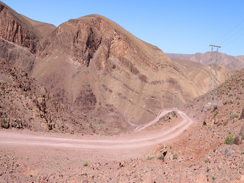
Géotourisme : Un tourisme de niche très peu développé
Géotourisme : Un tourisme de niche très peu développé * Le Maroc bénéficie de sites géologiques très variés mais peu visités par les touristes à cause de l
Savoir plus...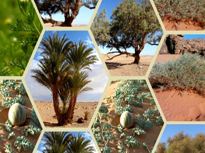
Le Géoparc Jbel Bani : Un sanctuaire de vie au cœur du désert marocain
Le Géoparc Jbel Bani : Un sanctuaire de vie au cœur du désert marocain Le désert marocain, souvent perçu comme un paysage aride et stérile, abrite en réalité une flore éto
Savoir plus...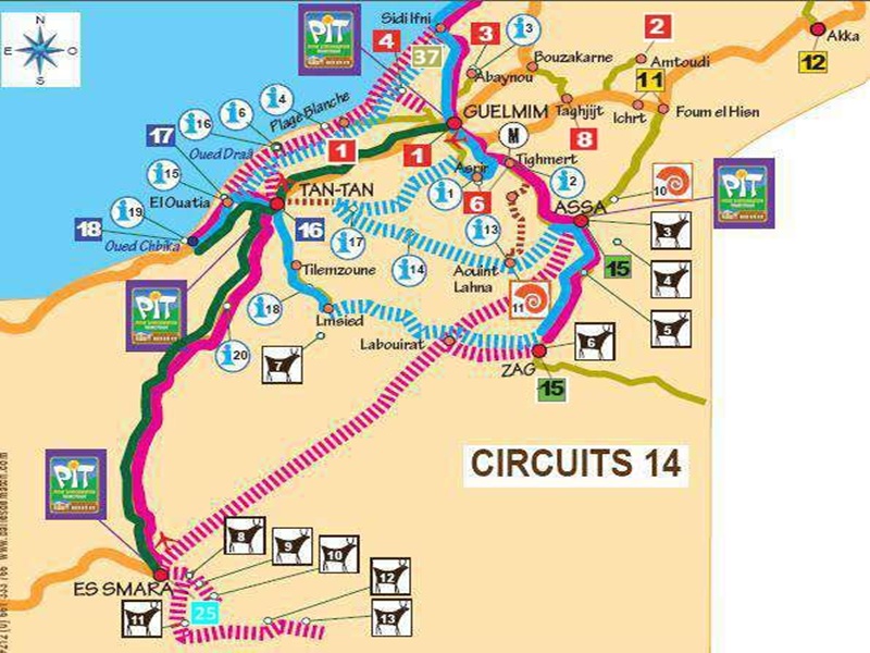
Circuits pistes du Sud Maroc-géoparc jbel bani
Circuits pistes du Sud Maroc-géoparc jbel bani Avec 4x4 : Sidi Ifni - Foum Assakak - Plage Blanche - Oued Draa - Tan Tan - (*) El Ouatia - Es Smara - Labouriat - Assa - Tan Tan - Asrir OU (*) El Ouatia - Lmsied - Zag - Assa
Savoir plus...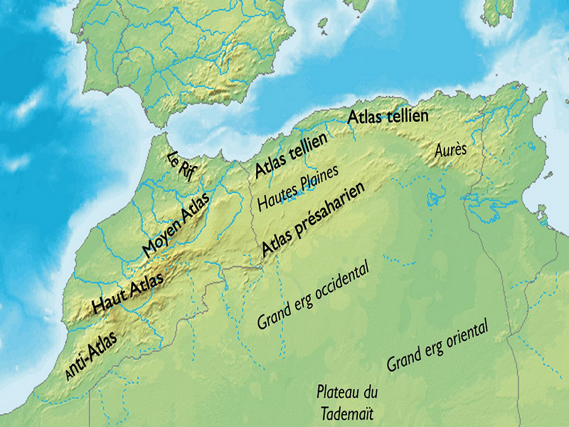
LES CHAINES DE MONTAGNE AU MAROC (Géoparc Jbel Bani)
LES CHAINES DE MONTAGNE AU MAROC (Géoparc Jbel Bani) C’est vrai que quand on pense au Maroc, on a tendance à penser au désert, et pourtant les montagnes occupent plus de deux tiers du territoire, incroyable
Savoir plus...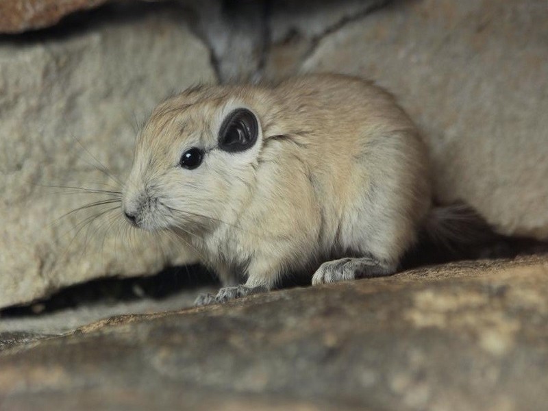
Le Goundi
Le Goundi est une espèce de petits rongeurs de la famille des Ctenodactylidae. C’est un rongeur et mammifère diurne qui habite les régions semi-désertiques de l’Afrique du Nord. Au Maroc on en
Savoir plus...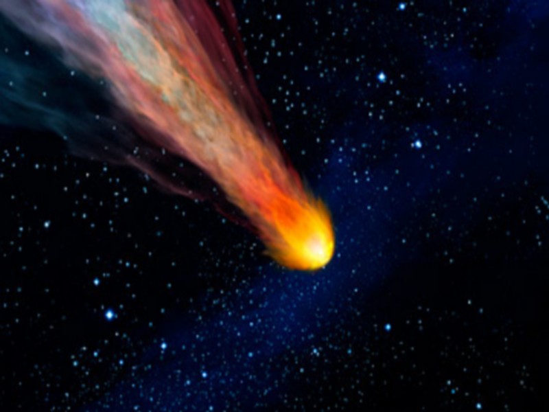
Qu'est ce qu'une météorite ?
De premiers abords cela ressemble souvent à un simple morceau de roche, mais il s’agit de matière extraterrestre âgée de 4,5 milliards d’années. Les météorites proviennent d
Savoir plus...Les tags en relation
En savoir plus sur " Géologie et TSGJB - AMDGJB ! "
Consulter les vidéos de " Géologie et TSGJB - AMDGJB ! " Consulter les photos de " Géologie et TSGJB - AMDGJB ! " Consulter les publications de " Géologie et TSGJB - AMDGJB ! " Consulter les éditions de " Géologie et TSGJB - AMDGJB ! " Consulter les communications de " Géologie et TSGJB - AMDGJB ! "Recherche du site
Recherche avancée / SpécifiqueVulgarisation à la géologie
Qu'est ce que les sciences de la terre: vulgarisation Qu'est ce que la géologie ? Géologie et TSGJB - AMDGJB !
Géoparc et Recherche Scientifique
Le coins de l’étudiant


Blog Géoparc Jbel Bani
Dictionnaire scientifique
Plus de 123.000 mots scientifiques
Les publications
Géo parc Jbel Bani

Circuits & excursions touristiques

cartothéques


Photothéques
Publications & éditions

