


STRUCTURAL EVOLUTION OF THE ANTI-ATLAS DOMAIN :AN OVERVIEW pour Yves Missenard
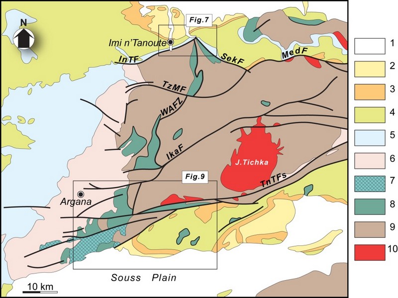
The Anti-Atlas represents the most important segments of the major Pan-African (≈0.5Ga) belt system of North Africa. This orogen exposed in a series of sporadic SW–NEtrending outcrops over 700km across southern Morocco, and reach ≈150km wide in the central part, west of Ouarzazate (Figure G1 & G2).Scattered outcrops of related rocks are described in NW Algeria which indicate that the belt continues from SE Morocco southeastwards with a NW–SEtrend.
The Anti-Atlas orogen comprises two main sequences of rocks: a metamorphic basement of Palaeoproterozoic (2Ga) age and the Neoproterozoic rocks. The Palaeoproterozoic rocks form the northern margin of the West African Craton mainly outcropping in the Reguibate Shield in Mauritania And Algeria. The Palaeoproterozoic basement is exposed in a series of uplifted inliers (‘‘boutonnieres’’) surrounded by the Neoproterozoic rocks that were locally deformed with the basement during the Pan African Orogeny. with the during the Pan African Orogeny.
Paleoproterozoic rocks and Eburnian orogeny
The oldest rocks of Morocco, Archean in age3 Ga(Montero et al, 2014) crop out in the southernmost Reguibat E shield which formsthe northern part the West African Craton (WAC).Further north, in the Anti-Atlas chain, the basement units are Paleoproterozoic (Taznakht Group, former” PI”)cropping only in the south of the Anti-Atlas Major Fault (AAMF). They are metamorphic rocks (greenschist to amphibolite facies) intruded by peraluminous and calc-alkaline granitoids dated around 2Ga(Thomas et al, 2002).The corresponding tectono-magmatic and metamorphic events are assigned to the Eburnian/Birimian orogeny.
Neoproterozoic rocks and Pan-African orogeny
As everywhere in the WAC, Mesoproterozoic rocks are lacking in the Anti-Atlas. Neoproterozoic Formations overlie directly the Paleoproterozoic basement. The Neoproterozoic/Paleoproterozoic boundary is generallya tectonic contact (thrust, strike-slip or detachment faults), and seldom a stratigraphic contact (Tizi n’Taghatine). Globally, the Neoproterozoic formations record three main stages of the Pan-African cycle (figureG4):
I .The early Neoproterozoic platform development is marked by the accumulation of thousands of meters of quartzites and stromatolitic limestones (Taghdoute Group, former “PII”), intruded by doleritic dykes and gabbroic intrusions. These rocks are associated with the rifting of the WAC margin, broadly contemporaneous with the oceanic accretion further north (760 Ma), witnessed along the AAMF by the Bou Azzer-El Graara and Siroua ophiolitic sequences (Bou Azzer Group).
II .Oceanic closure and subsequent Pan-African collision are associated with oceanic subduction along the northern margin of the WAC, ending with the accretion of oceanic arc formations (figureG4).The reported “blueschist facies” mineral associations in the Bou Azzer inlier are controversial. The polarity of the subduction remains also matter of debates; the same is true for the real location of the northern edge of the WAC. The oblique Pan-African collision(655 Ma to 640 Ma) generated south-verging thrust sheets onto the cratonic margin. South of the AAMF, the main Pan-African phase is recorded by low grade recrystallizations, synmetamorphic folds and various ductile and brittle structures in the Taghdout Group series.
III The Late to Post Pan-African extensional event is recorded by the extensive volcanic and volcano clastic series of the Ouarzazate Group (former “PIII”, 580 Ma to 560Ma), interbedded with subaerial to lacustrine deposits, which unconformably overlie the Eburnian and/or Pan-African basement units. The Ouarzazate Group shows abrupt variations of thickness and facies controlled by extensional tectonic activity. Various high-K calc-alkaline to alkaline plutons emplaced within the Ouarzazate Group, coeval with the volcanic rocks of comparable chemistry.

FigureG4: Generalized lithostratigraphic column for the Anti-Atlas Pan-African orogen. “PI” = “XI”, etc. are the classical stratigraphic symbols used on Anti-Atlas geological maps. HKCA: High-K calc-alkaline (granitoids) after Thomas et al. (2004), Gasquet et al. (2005) and Liégeois et al.2006 in Youbi et al., 2013

Source web par sociedadgeologica.es
Les articles en relation

Défense de l'Environnement- Partenaires - durabilité
La défense de l’environnement ne s’arrête pas à nos frontières Les problèmes environnementaux n’ont pas de frontières. La destruction de la biodiversité ou le changeme
Savoir plus...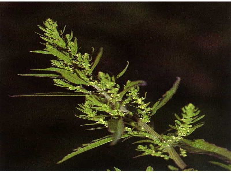
M’khinza, une plante toxique?
M’khinza, une plante toxique? Le Centre antipoison et de pharmacovigilance du Maroc (CAPM) met en garde les citoyens contre l’utilisation de M’khinza ou ansérine vermifuge. Le centre avait émis une ale
Savoir plus...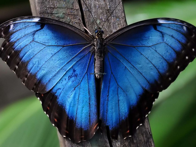
Des papillons Morpho émergent de leur chrysalide en time-lapse
Des papillons Morpho émergent de leur chrysalide en time-lapse On trouve le papillon Morpho dans les zones tropicales, principalement en Amérique centrale et en Amérique du Sud. Il a la particularité de vi
Savoir plus...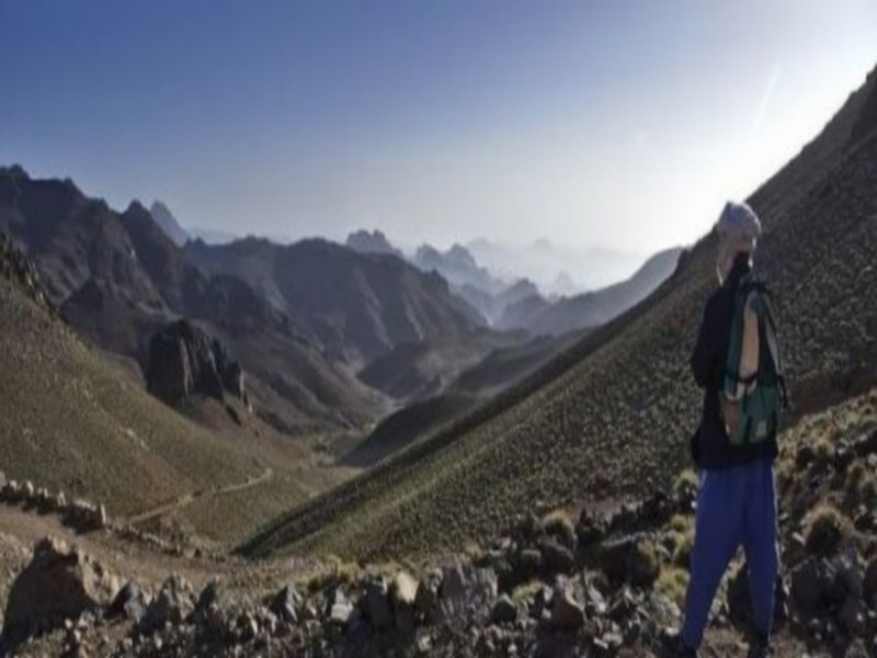
Jbel Saghro, paysage lunaire et fief de la tribu nomade légendaire des Ait Atta
Jbel Saghro offre des paysages à couper le souffle. Un endroit idéal pour faire des randonnées et des trekkings sur plusieurs jours. La région aux roches volcaniques de Saghro est notre volet touristique de l
Savoir plus...
Association Marocaine pour le Développement de Géoparc Jbel Bani (AMDGJB)
Association Marocaine pour le Développement de Géoparc Jbel Bani (AMDGJB) L'AMDGJB Association Marocaine pour le Développement de Jbel Bani, en tant qu'Association Marocaine autorisation 1954-36 &
Savoir plus...
Tribu Ahl Massa
Tribu Ahl Massa Histoire d'Ahl Massa Ahl Massa, ou Ait Massa, est une tribu berbère issue d'émigrés de diverses tribus de la région qui se regroupèrent autour des zaouiyas de Sidi Bahloul
Savoir plus...
CO2 dans l'atmosphère : une concentration record
CO2 dans l'atmosphère : une concentration record Avec 403 parties par million (ppm) de CO2 dans l'atmosphère en 2016, un record est battu, qui datait de plusieurs millions d'années. Pour réduir
Savoir plus...
Des dinosaures à Figuig
Des dinosaures à Figuig C’est inédit. Une équipe du laboratoire des «gîtes minéraux, hydrogéologie et environnement», de l’Université Mohammed Ier, a réce
Savoir plus...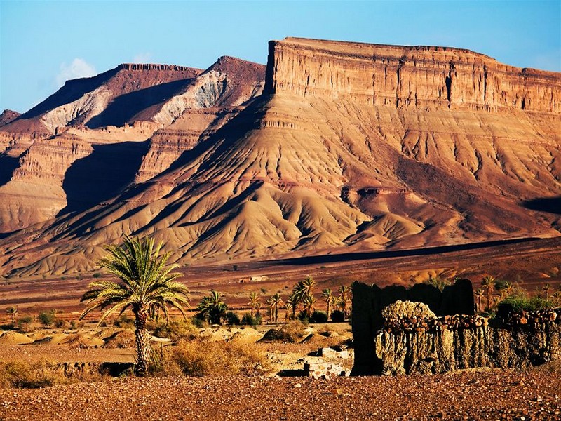
A plate tectonic evolution of the Anti-Atlas on a global scale
A plate tectonic evolution of the Anti-Atlas on a global scale DR.Hervé Rezeau, DR.Cyril Chelle-Michou & DR.Michael Calder SEG Student Chapter of Geneva (Switzerland) &n
Savoir plus...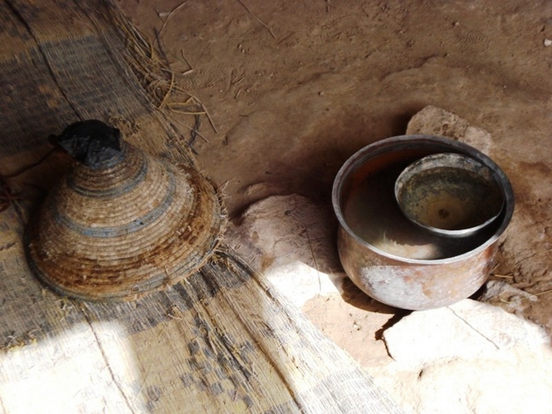
DAR TANASST et Horloge à eau
Nous quittons Tafraout en direction de Tata. Nous allons emprunter pour la première fois une nouvelle route qui mène plus directement à notre destination, nous évitant ainsi de remonter jusqu'à Igh
Savoir plus...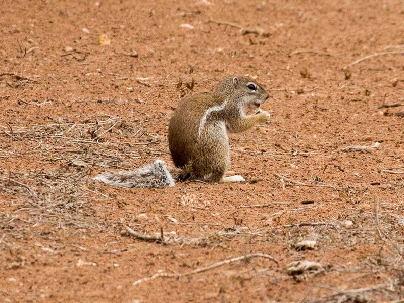
Parution d’une étude sur l’écureuil terrestre du Sénégal au Maroc
Parution d’une étude sur l’écureuil terrestre du Sénégal au Maroc Des scientifiques marocains, roumains et Slovènes ont délimité l’aire de répartition au Maroc
Savoir plus...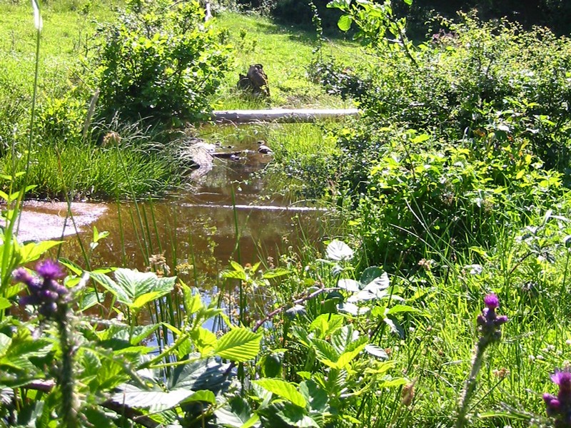
Bien-être et santé par la nature
Bien-être et santé par la nature Arbres, fleurs, soleil nous entourent au quotidien mais nous n'imaginons pas à quel point ils jouent un rôle dans notre vie. Humeur, comportement, émotions d&eacut
Savoir plus...Les tags en relation
En savoir plus sur " Géologie et TSGJB - AMDGJB ! "
Consulter les vidéos de " Géologie et TSGJB - AMDGJB ! " Consulter les photos de " Géologie et TSGJB - AMDGJB ! " Consulter les publications de " Géologie et TSGJB - AMDGJB ! " Consulter les éditions de " Géologie et TSGJB - AMDGJB ! " Consulter les communications de " Géologie et TSGJB - AMDGJB ! "Recherche du site
Recherche avancée / SpécifiqueVulgarisation à la géologie
Qu'est ce que les sciences de la terre: vulgarisation Qu'est ce que la géologie ? Géologie et TSGJB - AMDGJB !
Géoparc et Recherche Scientifique
Le coins de l’étudiant


Blog Géoparc Jbel Bani
Dictionnaire scientifique
Plus de 123.000 mots scientifiques
Les publications
Géo parc Jbel Bani

Circuits & excursions touristiques

cartothéques


Photothéques
Publications & éditions

